




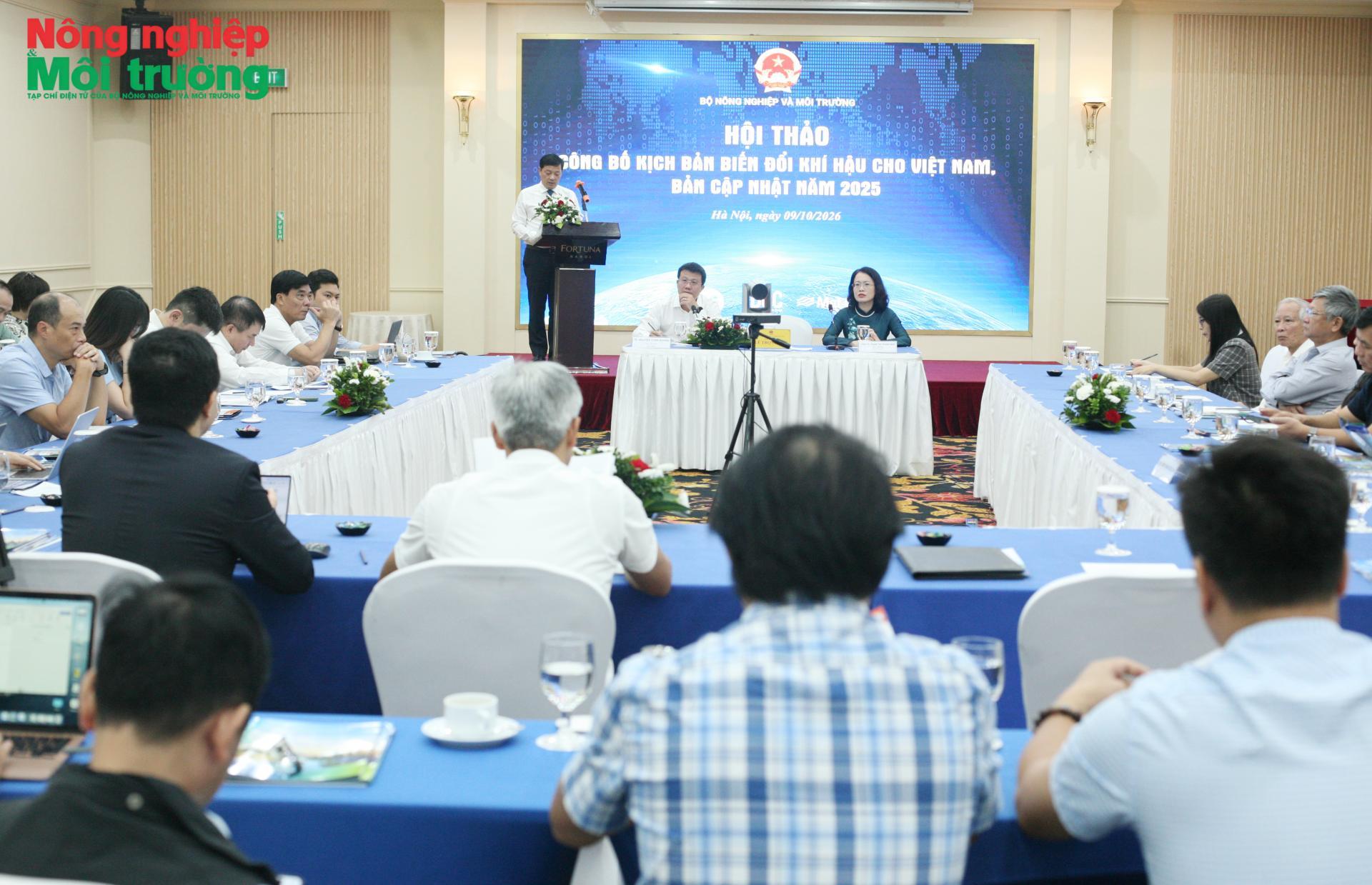
 On October 9, 2026, the Ministry of Agriculture and Environment held a conference in Hanoi to announce the 2025 update to Viet Nam’s climate change scenarios. With revised calculation methods, updated data and an expanded scope of risk assessment, the scenarios provide an enhanced scientific basis for policymaking, development planning and adaptation measures. Their value, however, depends not only on how clearly they identify potential future climate trends, but also on how effectively the information is incorporated into decision-making and implementation by ministries, agencies and local authorities.
Strengthening the scientific basis for climate policy
Climate change is placing increasing demands on natural resource management, environmental protection, disaster risk reduction and efforts to safeguard people and the economy. In this context, updating Viet Nam’s climate change scenarios involves more than incorporating new research findings. It also aims to strengthen the scientific basis for policymaking, planning and the selection of development pathways suited to changing climate conditions.

Speaking at the conference, Deputy Minister of Agriculture and Environment Le Trong Yen stressed the importance of proactively identifying future climate changes, assessing potential risks and preparing appropriate response measures. He noted that the 2025 update builds on previous editions while incorporating the latest scientific findings of the Intergovernmental Panel on Climate Change (IPCC), helping improve climate risk assessments and inform the selection of adaptation measures suited to different sectors and localities.
Since the first edition was released in 2009, Viet Nam’s climate change scenarios have been updated in 2012, 2016 and 2020. Each update has progressively strengthened the scientific basis, calculation methods and information systems used to assess climate impacts and incorporate climate considerations into socioeconomic development strategies, master plans and development plans.
The 2025 update draws on the IPCC’s Sixth Assessment Report and uses the latest generation of climate models under Phase 6 of the Coupled Model Intercomparison Project (CMIP6). It also shifts from the earlier approach based on Representative Concentration Pathways (RCPs) to Shared Socioeconomic Pathways (SSPs). This change allows future climate trends to be assessed in relation to different assumptions about economic development, population growth, technology, energy use and climate policy, broadening the basis for evaluating risks under alternative development pathways.
According to Assoc. Prof. Dr. Pham Thi Thanh Nga, Director General of the Institute of Meteorology, Hydrology, Environment and Marine Sciences, the development process included a consultation exercise using nearly 300 questionnaires to identify the information needs of ministries, agencies and local authorities. Technical work covered the processing of observational data, climate projections using dynamical and statistical methods, the development of higher-resolution datasets and consultations with experts.
The updated scenarios comprise eight chapters and detailed technical appendices, with additional material on urban climate, global warming levels, inundation risks, and guidance on accessing and using the information. These changes reflect an effort not only to improve modeling methods but also to make the resulting information more responsive to the increasingly specific needs of climate governance and planning.
The update also aligns with the direction set out in Conclusion No. 75-KL/TW, issued by the 14th Party Central Committee on July 28, 2026, on environmental protection and proactive climate change response in the new era. The conclusion identifies proactive climate change response, disaster risk reduction and improved safety for people and the economy as key priorities.
More detailed climate data to assess regional risks
One of the major changes in the 2025 update is its improved spatial resolution, expanded range of climate variables and more detailed information by location and period. In addition to temperature and rainfall, the scenarios cover wind, radiation and sea surface temperature, while expanding assessments of extreme events, sea-level rise and inundation risks.
Information presented at a consultation workshop in July 2025 indicated that the scenarios had a spatial resolution of approximately 10–15 kilometers nationwide and 5–10 kilometers in key areas, including the Mekong Delta and northern Viet Nam. Models used to develop extreme climate and urban climate scenarios achieved a resolution of up to 4.4 kilometers, compared with 25 kilometers nationwide in the 2020 edition.
The finer resolution allows climate differences between areas to be represented more clearly, providing additional information for assessing the risks of heavy rainfall, prolonged heat and other extreme events. This is particularly relevant to densely populated areas, regions experiencing rapid infrastructure development and locations highly exposed to natural hazards, where local topography and urban conditions can substantially influence the level of risk.
For the first time, the 2025 scenarios also provide information on extreme events under global warming levels of 1.5°C, 2°C, 3°C and 4°C relative to preindustrial levels. Results presented at the conference indicate that, under the high-emissions scenario, the number of hot days could increase by more than 50 days by the end of the 21st century, while the number of days with extreme heat could rise by around 20 days. Meanwhile, the number of days with severe cold in northern Viet Nam and the north-central region is projected to decline sharply.
Maximum one-day and five-day rainfall totals are projected to increase by around 30–40% in northern and southern Viet Nam. In some areas of northern Viet Nam, the Central Highlands and southern Viet Nam, the number of days with rainfall exceeding 100 millimeters could increase by 80–100% under the high-emissions scenario. These findings illustrate how climate risks may vary across regions and underscore the need to consider both national trends and local conditions when developing response measures.
For urban areas, the updated scenarios include dedicated assessments focusing on Hanoi and Ho Chi Minh City. These examine the combined effects of global warming and urbanization, including rising temperatures, heat extremes, the urban heat island effect and extreme rainfall, together with the associated risks to public health, buildings and infrastructure.
The update also revises projections of sea-level rise in the East Sea and along Viet Nam’s coastline and provides maps of potential inundation. By 2100, average sea-level rise across the East Sea is projected to range from 46.1 centimeters under the low scenario to 63.7 centimeters under the high scenario. Along Viet Nam’s entire coastline, the average rise by the end of the century is projected to reach approximately 61.9 centimeters under the high scenario, with an upper estimate of 82 centimeters. The Mekong Delta is identified as the region facing the highest inundation risk in the assessment.
Scientists caution, however, that the maps represent static inundation risk associated with sea-level rise and do not fully account for the effects of tides, flooding, coastline changes or dyke systems. The information is therefore primarily intended to identify areas of concern and guide more detailed studies, rather than serve as a precise prediction of inundation at specific locations.
Matching scenarios to planning and risk assessment needs
Alongside the expansion of climate information, the 2025 update highlights the need to select and interpret projections according to the purpose of each assessment or decision. This is important because climate data can support effective management only when their scientific basis, scope of application and limitations are properly understood.
Climate change scenarios are not forecasts of specific future conditions. Rather, they are scientifically grounded representations of plausible future climate trends based on the relationships among socioeconomic activities, greenhouse gas emissions, climate change and sea-level rise. Their results are subject to uncertainty arising from natural variability within the climate system, limitations in climate models and differences between emissions and socioeconomic pathways.
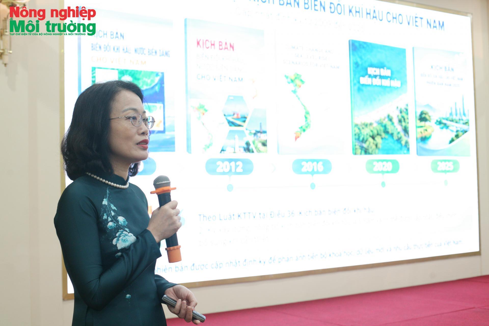
The 2025 update adopts three principal pathways: SSP1-2.6, representing sustainable development with low emissions; SSP2-4.5, representing an intermediate development pathway; and SSP3-7.0, representing high emissions. Each pathway reflects different assumptions about the future, allowing users to consider a range of potential risks rather than assume that climate change will follow a single trajectory.
For planning and design decisions tied to specific timeframes, technical guidance recommends using information from the SSP scenarios. Global warming levels, meanwhile, can help identify how risks change as the climate system reaches particular levels of warming, supporting the development of flexible adaptation pathways.
Scenario selection should also account for the intended service life and importance of the decision in question. Infrastructure with a long service life, limited scope for modification or potentially severe consequences in the event of failure needs to be assessed under less favorable climate conditions so that contingency measures can be prepared. For regional planning, transport and energy infrastructure, coastal structures and long-term investment projects, comparing intermediate and high-emissions scenarios can help assess the robustness of development plans under climate uncertainty.
Model results must also be considered alongside local topography, existing infrastructure, population distribution, disaster preparedness and available resources. Maps showing potential inundation from sea-level rise, for example, can help identify areas requiring priority assessment. However, their use in infrastructure design or disaster prevention planning requires more detailed analysis of tides, flooding, terrain and coastal protection systems.
This approach helps prevent the mechanical application of scenario data while allowing development decisions to account for different possible climate outcomes. From a governance perspective, the objective is not to select a single scenario for every sector, but to ensure that each decision is supported by scientific information appropriate to its purpose, timeframe and level of risk.
Expanding access to climate information for policy and planning
For research findings to inform practical action, access to and effective use of data must advance alongside improvements in the scientific quality of the scenarios. The 2025 update is available through the WebGIS platform at https://kichbanbdkhvn.mae.gov.vn/, which allows users to explore information by location and period, select SSP scenarios, compare projections across different timeframes and access the underlying database. Together with a summary for policymakers and the full report, the platform provides public agencies, organizations and other users with information for research, impact assessment and adaptation planning.
Deputy Minister Le Trong Yen emphasized the need to improve the use of the scenarios in management, policymaking, and the development of socioeconomic strategies, master plans and development plans. In line with this direction, the Ministry’s specialized agencies are expected to link research more closely with practical needs and strengthen technical guidance and support to help ministries, agencies and local authorities apply the information appropriately.

The Department of Climate Change has been tasked with expediting the drafting of a Law on Climate Change and coordinating with relevant agencies to guide the use of scenario information in planning and development processes. Maintaining and upgrading the WebGIS platform is also a priority to ensure that scientific data remain accessible, transparent and consistent nationwide.
The Institute of Meteorology, Hydrology, Environment and Marine Sciences is expected to continue improving the quality, spatial resolution and reliability of the scenarios. It is also to strengthen cooperation with ministries, agencies and local authorities in developing impact scenarios and assessing climate-related risks and losses across sectors and locations. Further development of climate information therefore needs to be accompanied by assessments of its practical implications, enabling research findings to better inform management and policymaking.
At the implementation level, ministries, agencies, local authorities, businesses and social organizations are expected to incorporate the scenarios into development strategies, master plans, development plans, business and production plans, long-term investment projects and risk management measures. In agriculture, climate information can help inform decisions on cropping calendars, crop structures and water management. In urban areas, data on heat, extreme rainfall and inundation risks can support reviews of land-use plans, drainage systems and technical infrastructure. In coastal areas, combining climate projections with information on topography, population and coastal protection infrastructure can help identify locations requiring further assessment and investment.
Effective application, however, depends on more than the level of detail in the data. It also requires local capacity to interpret the information, improved data sharing among sectors, and continued data updates and validation during implementation. These conditions are essential to ensure that climate information serves not merely as an additional source of data, but as a practical basis for selecting and adjusting development decisions.
The 2025 update is available through the WebGIS platform at https://kichbanbdkhvn.mae.gov.vn/, which allows users to explore information by location and period, select SSP scenarios, compare projections across different timeframes and access the underlying database. |
The 2025 update to Viet Nam’s climate change scenarios strengthens the scientific foundation for climate change response in the coming years. Continued improvements in research, clearer technical guidance and stronger capacity to use climate information will determine how effectively projections are translated into practical management measures. These efforts can help sectors and local authorities better anticipate climate risks and strengthen their capacity to adapt over the long term.

At a conference held on October 15 to mark World Food Day 2026 and strengthen cooperation on the implementation of Viet Nam’s “One million hectares of high-quality, low-emission rice scheme in the Mekong Delta”, the Ministry of Agriculture and Environment, the Food and Agriculture Organization of the United Nations (FAO) and development partners reviewed implementation progress, plans for expansion and resource needs for the next phase. Initial results indicate potential gains in production efficiency, lower input use and reduced emissions. However, scaling up the model will require closer coordination on infrastructure, production organization, market linkages and green finance.
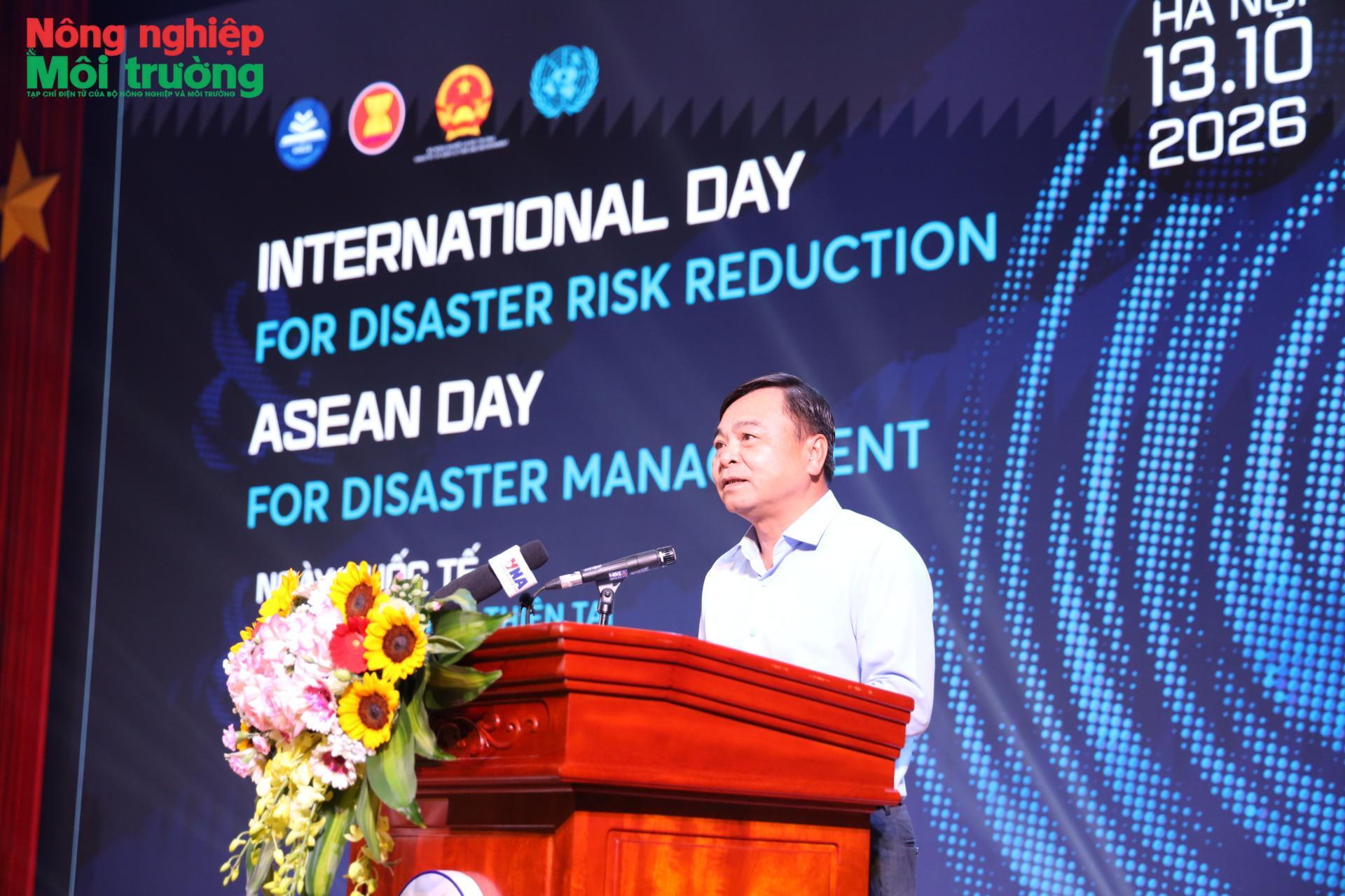
As disaster risks grow more complex, preparedness must extend beyond the response plans of authorities to include households, schools and communities. At a rally held in Hanoi on the afternoon of October 13 to mark the 2026 International Day for Disaster Risk Reduction and ASEAN Day for Disaster Management, the Ministry of Agriculture and Environment and its partners called for a shift toward proactive disaster risk management, underpinned by early warning, public awareness and community participation.
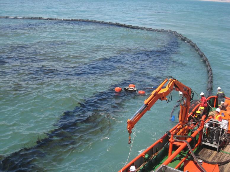
Two days of technical discussions at Far Eastern Federal University in Russia highlighted the need to translate technologies and response plans into operational capability. The Viet Nam Environmental Incident Response Center (SOS) shared its experience in using a WebGIS digital mapping platform to link resource locations with equipment status and management responsibilities, helping maintain readiness through routine operations.

An international conference held in Hanoi on Oct. 8, 2026, called for closer alignment between agricultural policy, technology and innovation and the practical needs of production. Deputy Minister of Agriculture and Environment Nguyen Quoc Tri said Vietnam needs to accelerate its shift toward knowledge-driven growth, higher-quality output and greater value creation, with scientific research judged by measurable improvements in production and farmers’ incomes.
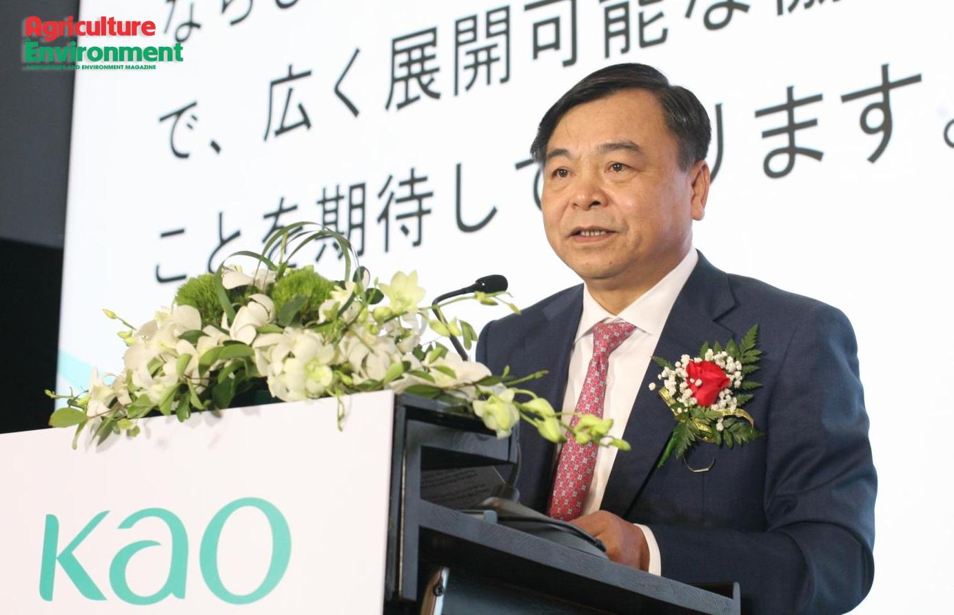
Deputy Minister of Agriculture and Environment Nguyen Hoang Hiep has urged businesses to focus on science and technology, green production, innovation to increase the value of agricultural products, and stronger linkages and public-private partnerships. Solutions should improve resource efficiency, reduce the impacts of chemicals and reflect actual production conditions. He made the remarks at a ceremony in Hanoi on October 6, 2026, where Kao Viet Nam announced initiatives to support sustainable agriculture as it marked 30 years of operations in the country.