


 The research project entitled “Development of a suitability map for Arabica coffee cultivation on sloping land in Dien Bien province using remote sensing data, GIS technology, and the analytic hierarchy process (AHP)” conducted by Dinh Xuan Hung, Bui Tuan Hai, and Nguyen Ngoc Sang of the Institute of Water Resources Planning represents a scientifically and practically significant study in the context of ongoing agricultural restructuring toward sustainable production systems that are better adapted to natural conditions and capable of utilizing land resources more efficiently in Viet Nam’s Northern midlands and mountainous region.
Dien Bien favored for Arabica coffee expansion
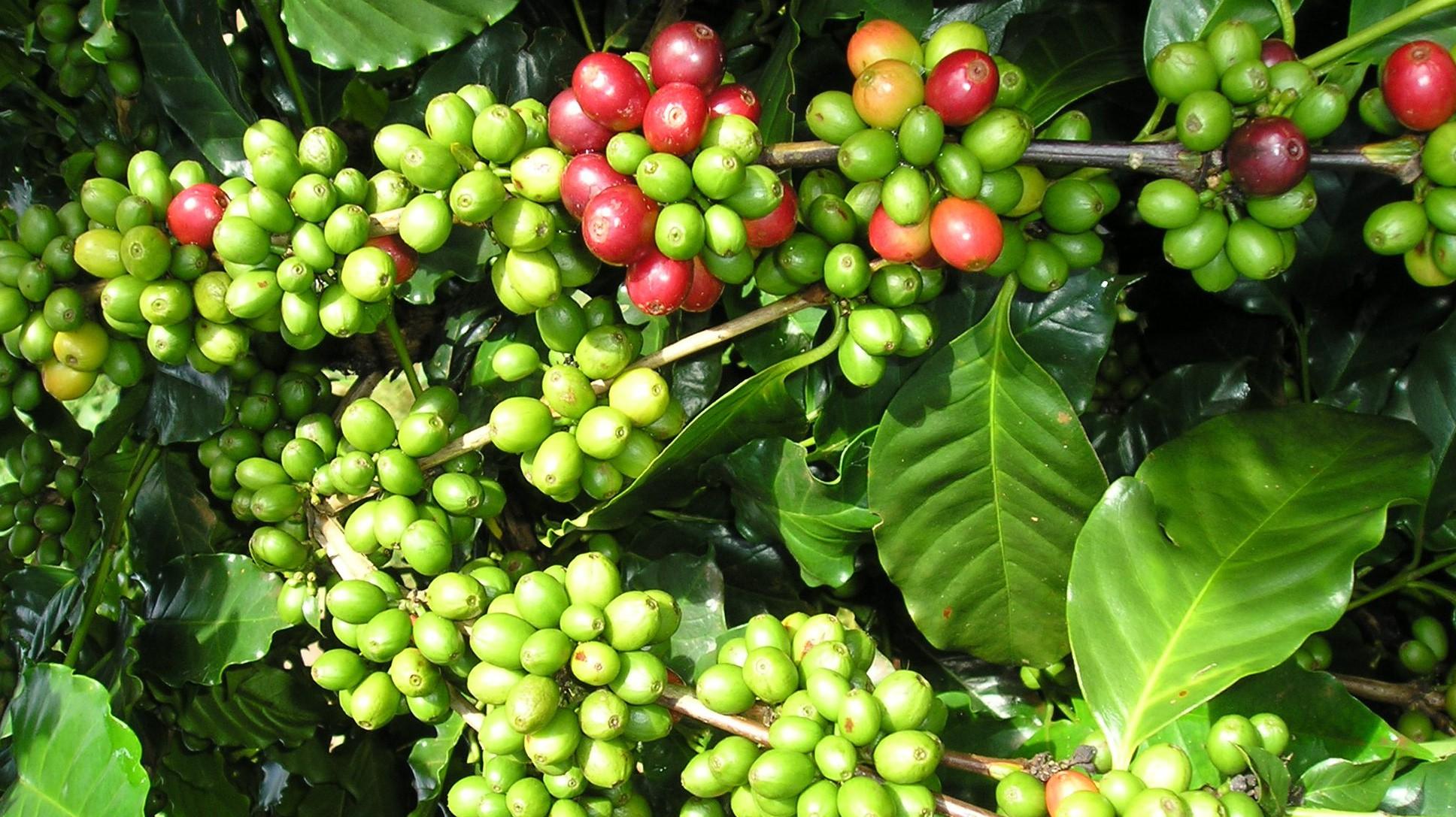
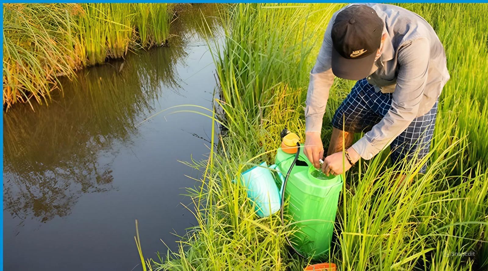
In recent years, alongside the expansion of commodity-oriented agriculture and increasing demand for higher production value per unit of cultivated land, many mountainous localities have accelerated the conversion of low-efficiency crops into industrial crops and fruit trees with higher economic returns. In Dien Bien province, where the terrain is predominantly mountainous and steep, the cool climate and distinctive ecological conditions have been assessed as highly suitable for Arabica coffee cultivation—a high-value crop that is increasingly strengthening its position in both domestic and international markets.
Unlike Robusta coffee, which currently accounts for the majority of Viet Nam’s coffee production, Arabica coffee requires relatively stringent ecological conditions, particularly in terms of elevation, temperature, rainfall, and soil quality. Arabica is also widely recognized for its superior bean quality, flavor profile, and commercial value. Therefore, identifying areas suitable for Arabica coffee cultivation is critically important for agricultural land-use planning, sustainable land management, and improving local economic efficiency.
In response to these practical requirements, the research team adopted an approach integrating modern technologies, including remote sensing data, Geographic Information Systems (GIS), and the Analytic Hierarchy Process (AHP), to evaluate the suitability of natural conditions for Arabica coffee cultivation across Dien Bien province. This interdisciplinary approach combines spatial data science, water resources studies, soil science, and agricultural planning.
GIS and satellite data used to assess coffee suitability
One notable strength of the study lies in its integration of multiple reliable input datasets. The researchers used a Digital Elevation Model (DEM) derived from NASA’s Shuttle Radar Topography Mission (SRTM) with a spatial resolution of 30 meters to assess topographic characteristics and calculate slope gradients. This globally recognized remote sensing dataset is particularly suitable for mountainous regions with relatively stable terrain conditions, such as Dien Bien province. Slope data were generated from the DEM using the “Slope” tool in QGIS software to determine terrain inclination, a factor directly affecting cultivation feasibility and the growth of Arabica coffee.
In addition, the study utilized CHIRPS satellite precipitation data for the 1981–2025 period to calculate mean annual rainfall. CHIRPS is a widely used satellite-based precipitation dataset in meteorological and hydrological research and has been validated in numerous previous scientific studies. The research team also incorporated soil data from the National Water Resources Atlas of the former Ministry of Natural Resources and Environment (now the Ministry of Agriculture and Environment), annual specific runoff modulus data compiled by the Institute of Water Resources Planning from observational records, together with current agricultural land-use data for Dien Bien province.
Based on these datasets, the study assessed the development potential for Arabica coffee cultivation using five primary criteria: elevation, slope, soil type, mean annual rainfall, and specific runoff modulus. These factors all have direct impacts on crop growth, productivity, and adaptability on sloping land.
To determine the relative importance of each criterion, the research team applied the Analytic Hierarchy Process (AHP), a multi-criteria decision-making method developed by Thomas L. Saaty in 1980. AHP has been widely used in resource management, environmental planning, and agricultural studies because of its ability to quantify both qualitative and quantitative factors through pairwise comparison matrices.
The criteria were evaluated using Saaty’s 1–9 scale to determine the relative importance of each factor. Following matrix normalization, the researchers calculated weighting coefficients for each criterion. The results indicated that elevation had the highest weight (Wi = 0.36), followed by soil type (Wi = 0.28), slope (Wi = 0.18), rainfall (Wi = 0.11), and specific runoff modulus, which had the lowest weight (Wi = 0.07).
These findings accurately reflect the ecological characteristics of Arabica coffee, which is particularly well suited to high-altitude areas with cool climates and favorable soil conditions. According to the study, elevations ranging from 1,000 to 2,000 meters were classified as “highly suitable,” whereas areas below 600 meters or above 2,000 meters were categorized as “unsuitable.” Regarding soil conditions, red-brown and yellow-brown soils were identified as the most suitable for Arabica coffee cultivation.
Another important aspect of the study was the validation of the logical consistency and reliability of the pairwise comparison matrix through the Consistency Ratio (CR). According to AHP methodology, a matrix is considered acceptable when CR < 0.1. The study reported a CR value of only 0.02, substantially lower than the threshold value. This demonstrates that the established criteria system and weighting structure exhibited a high degree of consistency and objectively reflected the relationships among natural factors influencing Arabica coffee development.
After determining the weights and suitability levels for each criterion, the research team used GIS technology to overlay spatial data layers and construct a suitability map for Arabica coffee cultivation across Dien Bien Province. Suitability levels were classified into three categories: unsuitable, suitable, and highly suitable.
Study maps prime Arabica coffee areas in Dien Bien
The results indicate that most agricultural land in Dien Bien Province has potential for Arabica coffee cultivation. Specifically, approximately 331,759 hectares, accounting for 82.5% of the total study area, were classified as “suitable.” This category represented the largest proportion and was widely distributed across the province, particularly in communes such as Na Sang, Si Pa Phin, and Na Hy.
Meanwhile, approximately 27,557 hectares, equivalent to 6.86% of the study area, were classified as “highly suitable,” mainly concentrated in communes including Si Pa Phin, Sang Nhe, Sinh Phinh, Pu Nhung, Pu Nhi, and Na Son. These areas were identified as possessing particularly favorable ecological conditions for the development of high-quality Arabica coffee production zones.
Conversely, “unsuitable” areas accounted for only about 10.64%, corresponding to approximately 42,802 hectares, primarily located in areas where terrain or water resource conditions were unfavorable, such as Muong Cha, Muong Lay, and Sin Chai.
Based on these analytical results, the study confirms that Dien Bien province possesses considerable natural advantages for Arabica coffee cultivation on sloping land. The findings provide an important scientific basis for agricultural zoning and land-use planning, while also supporting crop restructuring aimed at increasing economic value and promoting sustainable agricultural development.
Particularly in the context of climate change and increasing demands for efficient land-resource management, the application of remote sensing data, GIS, and AHP modeling demonstrates substantial advantages for crop suitability assessment. This approach enables the simultaneous integration of multiple environmental factors, supports large-scale spatial analysis, reduces assessment time, and improves accuracy compared with conventional assessment methods.
Beyond its academic contributions, the study also carries significant practical implications for management agencies, policymakers, and local authorities in formulating agricultural development strategies. The research findings may serve as a basis for reviewing land-use planning, identifying priority areas for Arabica coffee expansion, developing specialized commodity production zones, and attracting investment in processing and product marketing.
The authors also explicitly acknowledged certain limitations of the study. Specifically, water resource assessment was primarily based on natural conditions and did not comprehensively account for the impacts of irrigation infrastructure systems and actual irrigation water supply capacity. According to the research team, future studies should incorporate additional factors such as transportation infrastructure, proximity to processing facilities, socio-economic conditions, and climate change impacts to further refine the suitability assessment model.
Overall, the study entitled “Development of a suitability map for Arabica coffee cultivation on sloping land in Dien Bien province using remote sensing data, GIS technology, and the analytic hierarchy process (AHP)” represents a highly applicable research contribution that strengthens the scientific basis for Arabica coffee development in Viet Nam’s Northern mountainous region. At the same time, the study highlights the increasingly important role of digital technologies, spatial data, and multi-criteria analytical models in natural resource management, agricultural planning, and sustainable rural economic development.
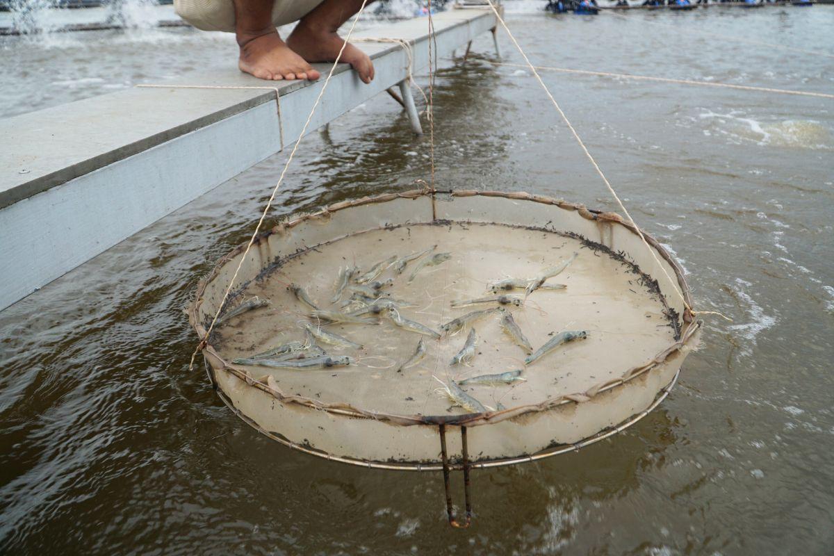
Intensive shrimp farming generates substantial economic benefits but also exerts increasing pressure on aquatic environments, particularly through wastewater rich in organic matter and toxic byproducts generated during farming operations. In the context where many shrimp farms still lack appropriate wastewater treatment systems, a research team from Can Tho University and Toan Viet Technological Environment Company Limited conducted an experimental study to assess the potential use of fishing nets—a readily available, low-cost material—as a filter material for biological treatment of wastewater from intensive shrimp ponds.
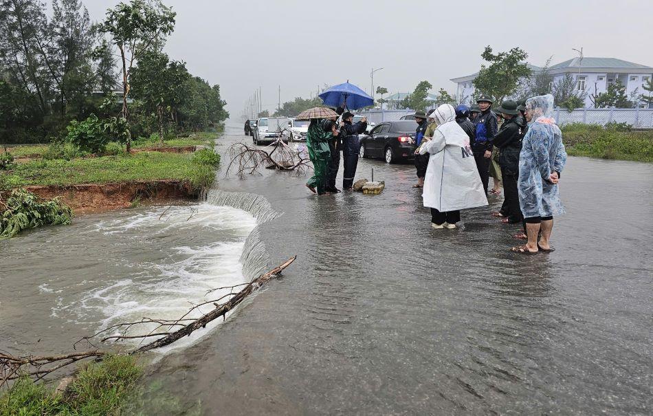
As floods become increasingly complex and extreme in Viet Nam’s North Central region, the demand for an early warning system that is reliable, fast to operate, and suitable for local-level application has become more urgent than ever. A research team from the Vietnam Academy for Water Resources—including Nguyen Thanh Hung, Vu Dinh Cuong, Trieu Quang Quan, and Nguyen Anh Hung—has developed an integrated technological solution that combines flood and inundation forecasting with modern communication tools. The study aims not only to enhance forecasting capacity but also to ensure that warning information reaches the right people at the right time under emergency flood conditions.
The use of pesticides is an integral part of modern intensive agriculture. Alongside their effectiveness in controlling pests and diseases, however, comes the risk of environmental pollution from wastewater generated during the production, formulation, and application of chemical active ingredients. Of particular concern is the fact that many pesticide compounds are poorly biodegradable, persistent in the environment, and prone to bioaccumulation, posing major challenges for wastewater treatment.
Steep terrain, concentrated heavy rainfall, and the increasingly evident impacts of climate change are placing Son La province’s land resources under growing pressure from soil erosion. By applying Geographic Information Systems (GIS) and the Revised Universal Soil Loss Equation (RUSLE), a research team comprising Tran Xuan Bien, Nguyen Van Huong, Luu Thuy Duong, and Tran Xuan Mien from the Hanoi University of Natural Resources and Environment and the Hanoi University of Mining and Geology has conducted a comprehensive study to assess the extent, severity, and spatial distribution of rainfall-induced soil erosion across the province. The findings offer an important scientific basis for land resource management and the formulation of sustainable development solutions in Son La.
As demand for construction materials continues to rise while conventional natural resources are gradually depleted, the search for sustainable, environmentally friendly production solutions has become increasingly urgent. Two scientific studies conducted by Dr. Pham Van Chung of Hanoi University of Natural Resources and Environment have identified a promising new pathway: the use of hillside soil, coal ash, and industrial by-products as raw materials for tunnel-kiln brick production within a circular economy framework.