




 By integrating remote sensing data, geographic information systems (GIS), and the Analytic Hierarchy Process (AHP), researchers from the Institute of Water Resources Planning developed a map assessing the potential suitability of sloping land for Arabica coffee cultivation in Dien Bien province. The assessment classified 276,597 ha as having potential and 92,872 ha as having very high potential, providing a scientific basis for selecting growing areas, planning production, and restructuring crops in accordance with local natural conditions.
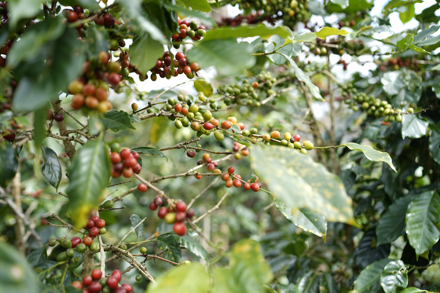
Dien Bien’s ecological conditions point to Arabica coffee potential
Arabica coffee is a high-value cash crop suited to areas with cool climates, relatively high elevations, and favorable soil conditions. According to the crop requirements cited in the study, Arabica coffee can grow at elevations ranging from 600 to 2,000 m above sea level, with elevations above 1,000 m considered particularly suitable. The optimal temperature range for its growth is approximately 15–24°C, while average annual rainfall of 1,500–2,000 mm is considered suitable.
In Viet Nam, coffee production is concentrated primarily on Robusta coffee, while Arabica has yet to achieve a position commensurate with its ecological potential in many mountainous areas. With its mountainous terrain, varied elevations, relatively cool climate, and extensive areas with favorable soil conditions, Dien Bien is considered to have considerable potential for Arabica coffee cultivation.
In practice, coffee cultivation is becoming an increasingly important component of agricultural restructuring in the province. According to figures cited in the study, the total coffee-growing area in Dien Bien reached 8,378 ha in 2026, representing a year-on-year increase of 77.21%. The expansion of coffee cultivation highlights its growing role in the province's crop structure while underscoring the need to identify appropriate growing areas to capitalize on natural advantages and improve land-use efficiency.
However, the province's mountainous terrain and steep slopes create considerable spatial variation in agricultural conditions. Elevation, soil characteristics, rainfall, and water availability all influence crop suitability. An area with favorable elevation may not necessarily be suitable for Arabica coffee cultivation if its soil conditions or water resources do not meet the crop's requirements.
Accordingly, identifying areas with cultivation potential requires an integrated assessment of multiple natural factors rather than consideration of only a few ecological conditions in isolation. This provided the basis for Dinh Xuan Hung, Bui Tuan Hai, Nguyen Ngoc Sang, and Tran Thi Thanh Dung to conduct a study aimed at mapping the potential for Arabica coffee cultivation on sloping land in Dien Bien province.
Soil and elevation carry the greatest weight
A notable feature of the study is its integration of three tools: remote sensing, geographic information systems (GIS), and the Analytic Hierarchy Process (AHP). Each serves a distinct function in the assessment. Remote sensing data provide spatial information on elevation and rainfall; GIS supports the processing and integration of data layers; and AHP is used to determine the relative importance of individual criteria in the assessment model.
Five factors were included in the analysis: soil, elevation, average annual rainfall, slope, and annual runoff modulus. These natural factors are directly or indirectly related to Arabica coffee growth and the conditions required for agricultural production on sloping land.
The study drew on data from multiple sources. The digital elevation model (DEM) was derived from NASA's Shuttle Radar Topography Mission (SRTM) data at a spatial resolution of 30 m. Rainfall data came from the Climate Hazards Group InfraRed Precipitation with Station data (CHIRPS) dataset for the 1981–2025 period. Soil information was obtained from the National Water Resources Atlas, while annual runoff modulus data were developed from hydrological observations at monitoring stations across Dien Bien Province. The resulting information layers were subsequently processed and integrated in GIS for the assessment.
Under the AHP framework, the criteria were evaluated through pairwise comparisons using Saaty's scale to quantify their relative importance. The results assigned the highest weight to soil, at 0.41, followed by elevation, at 0.27. Average annual rainfall had a weight of 0.16, slope 0.11, and annual runoff modulus 0.05.
This distribution of weights reflects the research team's prioritization of the ecological conditions relevant to Arabica coffee cultivation, with soil characteristics and elevation receiving the greatest emphasis in the assessment. Rainfall, slope, and annual runoff modulus provide additional information for evaluating growing conditions and water availability.
To assess the consistency of the pairwise comparison process, the researchers calculated the consistency ratio (CR). The resulting CR was 0.08, below the acceptable threshold of 0.1 under the AHP method. This indicates that the pairwise comparison matrix achieved the required level of internal consistency for the weighting procedure used in the study.
By integrating these five factors, the assessment goes beyond examining topography or soil characteristics separately and considers multiple natural conditions associated with the potential for Arabica coffee cultivation. The results are presented in a spatial map that identifies variations in cultivation potential across different areas of the province.
The map identifies areas with greater cultivation potential
Based on the integrated criteria and AHP results, the research team developed a map classifying the potential for Arabica coffee cultivation on sloping land in Dien Bien into three categories: no potential, potential, and very high potential.
The assessment identified approximately 27,153 ha in the no-potential category, equivalent to 2.84%; 276,597 ha in the potential category, accounting for 28.96%; and 92,872 ha in the very-high-potential category, representing 9.72%, according to the percentages reported in the study. The latter two categories are particularly relevant when considering the province's development priorities for Arabica coffee cultivation.
Areas classified as having potential are distributed across a relatively broad part of the province. These include several localities, notably Muong Ang, Na Sang, Si Pa Phin, and Na Hy. Areas classified as having very high potential include Muong Ang, Si Pa Phin, Sang Nhe, Sinh Phinh, Pu Nhung, Pu Nhi, and Na Son.
Muong Ang is a notable example in the spatial assessment. According to the study, approximately 1,239 ha in this locality were classified as having very high potential, equivalent to around 14.25% of the area assessed, while another 2,893 ha were classified as having potential, accounting for approximately 33.5%. These findings indicate that Muong Ang is among the areas with favorable conditions for further consideration of Arabica coffee development in accordance with local ecological characteristics.
The value of the map extends beyond quantifying the area assigned to each potential category. More importantly, it illustrates the spatial variation in natural conditions across the province, helping identify areas with greater cultivation potential as well as those requiring more careful consideration when selecting crops.
For a mountainous province with highly dissected terrain such as Dien Bien, spatial classification provides practical information for agricultural site selection. Rather than assessing the province's potential as a whole, local authorities can use the map as a reference to identify areas requiring priority field surveys, more detailed assessments, and further consideration in plans for Arabica coffee cultivation.
It is important to emphasize that the areas classified as having potential or very high potential represent the results of an assessment based on the natural criteria incorporated into the model. They should not be interpreted as areas that can all be immediately converted into coffee production. The selection of specific areas must also take into account current land use, water supply conditions, production infrastructure, and relevant planning requirements.
Informing land-use planning and crop restructuring
In mountainous areas, where agricultural production needs to be aligned with the sustainable use of land and water resources, potential mapping can serve as a decision-support tool. The findings provide additional scientific evidence to help authorities review land-use planning orientations, identify suitable areas, and consider expanding Arabica coffee cultivation where ecological conditions are favorable.
One of the notable strengths of the approach is its ability to quantify and integrate multiple criteria within a single assessment framework. Remote sensing and GIS enable the spatial representation of natural characteristics, while AHP supports the determination of weights assigned to individual criteria. This integrated approach can contribute to more systematic land suitability assessments and provide a useful spatial information base for production planning in areas with complex terrain.
For Arabica coffee cultivation on sloping land, information on annual runoff modulus is also relevant to assessing water availability. This factor can inform the development of appropriate irrigation and water management measures, particularly given seasonal variations in water availability. When the potential map is combined with assessments of water resources and existing irrigation infrastructure, local authorities can obtain additional evidence to select production arrangements suited to the conditions of individual areas.
The findings also suggest that the integrated remote sensing, GIS, and AHP approach could be applied to assess the cultivation potential of other high-value crops in mountainous areas. Adjusting the assessment criteria to reflect the growth requirements of each crop, together with the use of spatial data at appropriate resolutions, could provide a more systematic basis for evaluating and selecting agricultural production areas.
To strengthen the practical value of the assessment, the authors also point to the need for further validation of the criterion weights using field data, actual yields, and the distribution of existing coffee-growing areas, as well as sensitivity analysis to examine how changes in weights affect the results. Incorporating additional information on irrigation infrastructure, irrigation water availability, socioeconomic conditions, and distances to roads and processing facilities would also support a more comprehensive assessment of the prospects for Arabica coffee development. These factors are particularly relevant given that climatic conditions, land use, and water regimes may change over time.
The study by the research team from the Institute of Water Resources Planning contributes to a clearer understanding of the spatial potential for Arabica coffee cultivation on sloping land in Dien Bien through a data-driven, multi-criteria assessment approach. The resulting map does not replace field surveys, detailed planning, or assessments of production feasibility, but it provides a valuable layer of scientific information to inform subsequent evaluations.
Applying the findings in conjunction with crop-area planning, water resources management, and actual production conditions could help improve the use of sloping land while supporting the development of high-value crops suited to Dien Bien's ecological advantages.
Sources: This article is based on the study “Application of remote sensing dât, geographic information systems, and analytic hierarchy process (AHP) methodology in constructing a map of the potential for Arabica coffee cultivation on sloping land in Dien Bien province” by Dinh Xuan Hung, Bui Tuan Hai, Nguyen Ngoc Sang and Tran Thi Thanh Dung, published in the Science Journal of Agriculture and Environment, Issue 1, September 2026.

Rapid urbanization and tourism development are reshaping land-cover patterns in Phu Quoc, increasing the need for effective resource monitoring and management. Using Landsat satellite imagery combined with machine-learning algorithms, a team of Vietnamese researchers analyzed land-cover changes during 2010–2025. The study identified areas where land cover remained stable, locations experiencing frequent transitions, and areas classified as having undergone land-cover recovery. The findings provide additional scientific evidence to support land resource monitoring, forest conservation, and more effective land-use planning in the area.
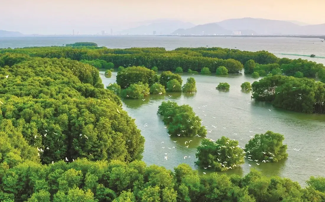
By integrating Sentinel-2 satellite imagery, GEDI data and the Google Earth Engine platform, researchers Vu Thi Hoai Thu, Dang Thi Kieu Oanh and Trieu Anh Ngoc have developed a map showing the spatial distribution of aboveground carbon stocks across vegetated classes in the Thi Nai Lagoon area. The total aboveground carbon stock was estimated at more than 71,500 metric tons, demonstrating the potential of combining remote sensing data and machine learning for biomass monitoring, identifying areas of carbon accumulation and supporting lagoon ecosystem management.
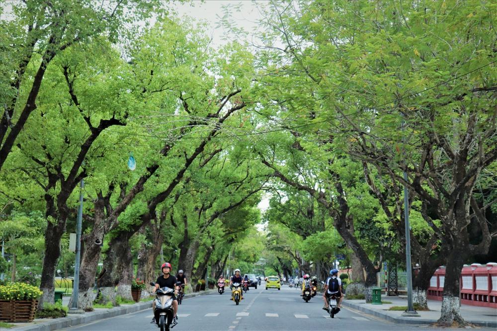
Urban green space plays an important role in improving environmental quality and supporting sustainable urban development. A study by Nguyen Ngoc Thanh, Nguyen Duy Phong, Tran Thi Thuy Huong and Pham Quoc Trung employed a hierarchical classification method based on Normalized Difference Vegetation Index (NDVI) thresholds derived from Sentinel-2A satellite data to identify urban green spaces in Hue City Center. A dataset comprising 100 ground-truth points was used to validate the classification maps.
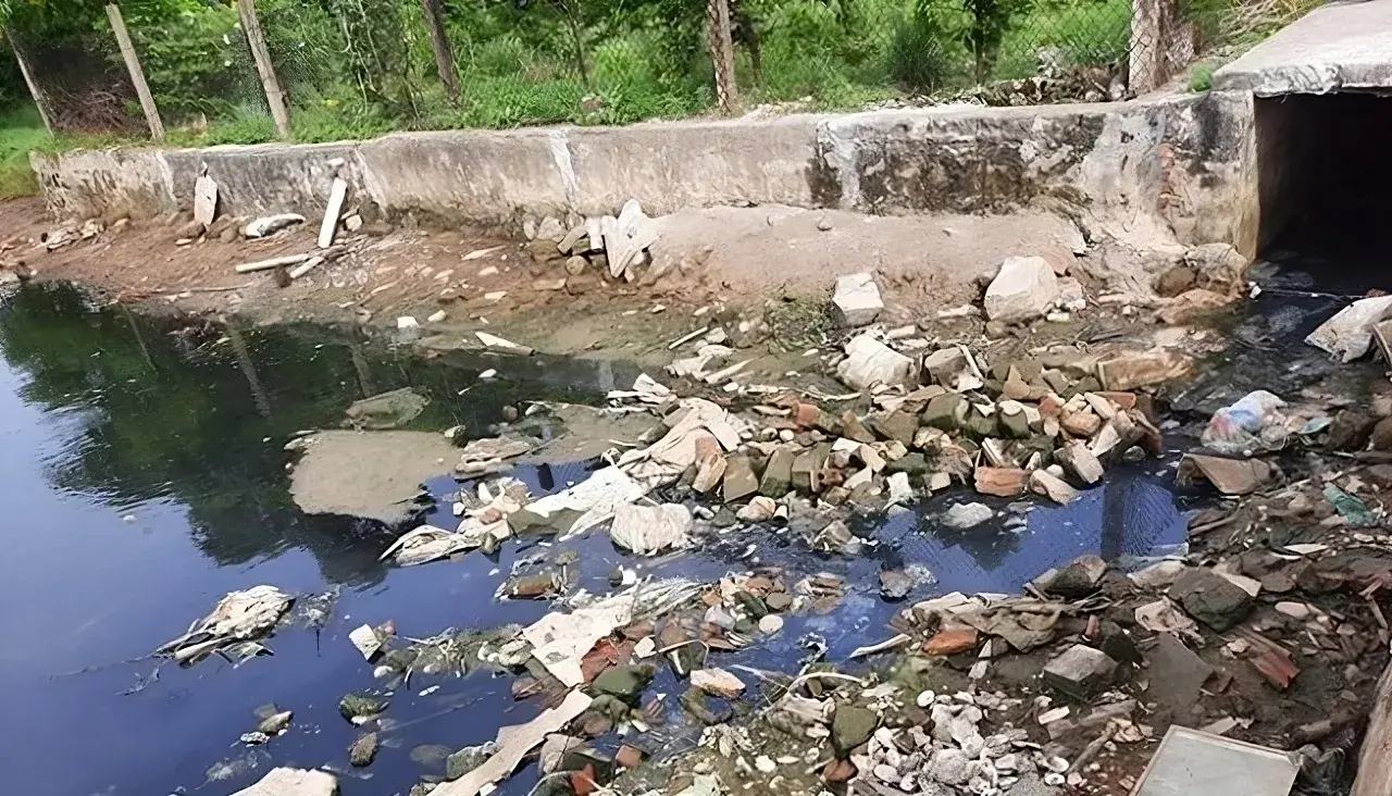
The application of low-frequency ultrasound irradiation to domestic wastewater has demonstrated its potential to reduce organic matter and microbial counts in experimental samples, according to a study by Hoang Duc An, Huynh Thi Minh Thanh, and Vo Thi Hong Phuong of the Faculty of Natural Sciences, Quy Nhon University. The findings also indicate that treatment performance depends on operating conditions and influent wastewater quality, suggesting that ultrasound could serve as a supplementary step in wastewater treatment processes.
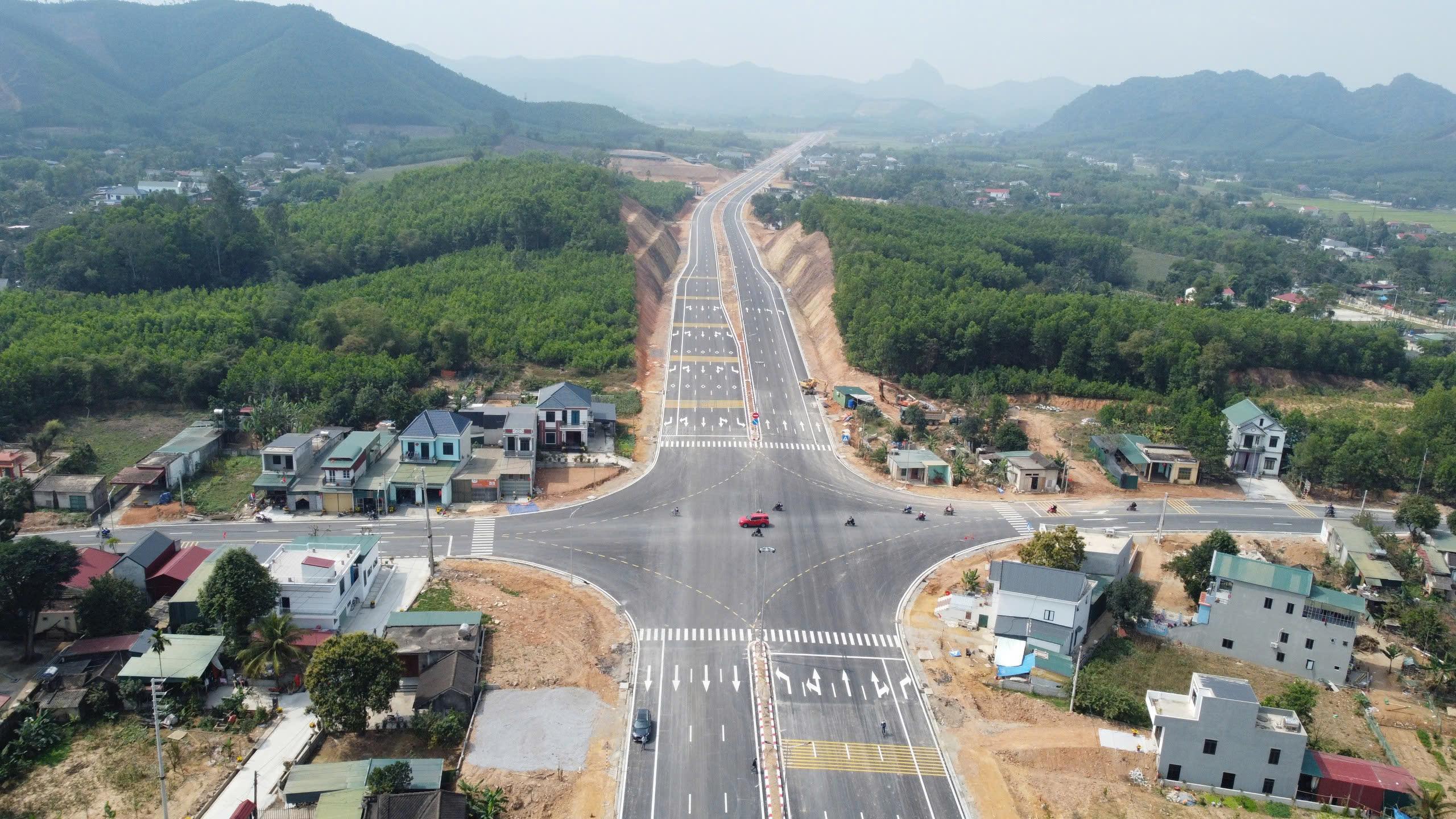
A study by Tran Thanh Son and colleagues on the Ben En–Ben Sung town center road project, in what is now Nhu Thanh commune, Thanh Hoa province, Viet Nam, demonstrates that integrating unmanned aerial vehicle (UAV) photogrammetry with MicroStation V8i can produce a land-use status map that meets the accuracy requirements for large-scale mapping. The results provide detailed geospatial data and identify 136,032.6 m² of land within the project’s acquisition boundary, supporting land inventory and the preparation of compensation, assistance, and resettlement plans.