



 A land database can fully realize its value only when its data are accurate, complete, clean, up to date, and capable of being connected to and shared across the state management system. A study by Nguyen Dinh Trung of Vietnam National University of Agriculture and Nguyen Quang Thi of Thai Nguyen University of Agriculture and Forestry shows that applying VBDLIS in Nghe An province provided substantial support for organizing, reviewing, supplementing, synchronizing, and utilizing land data during the campaign to enrich and clean the national land database.
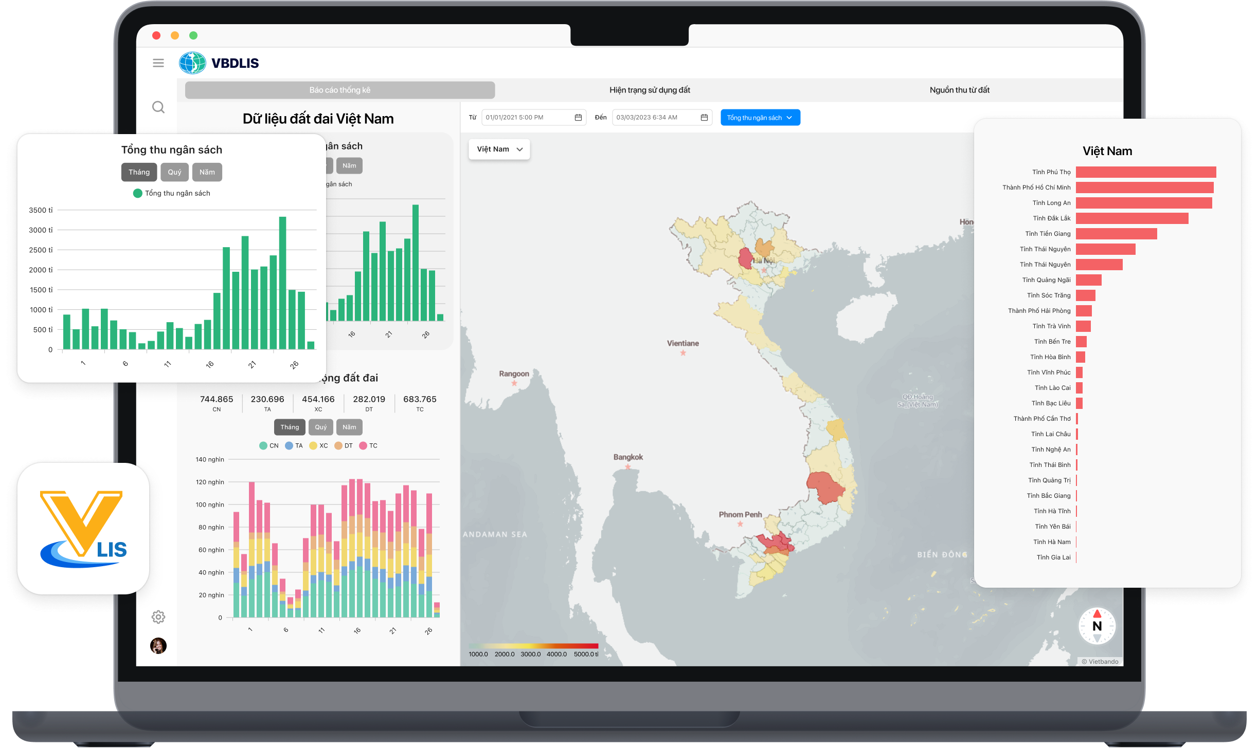
The study also identifies limitations related to data quality, authentication, interoperability, and resources, underscoring the need for continued improvement of technical infrastructure and operational mechanisms for land data management.
Building a reliable land database for effective land management
Amid the digital transformation process, land databases are playing an increasingly important role in state management. Land is a special national resource, while information on land parcels, land users, land-attached assets, and related changes needs to be continuously updated, centrally managed, and consistently utilized. Accordingly, developing a high-quality land database is not merely a technical requirement; it is also directly linked to the effectiveness of land management and use.
Plan No. 515/KH-BCA-BNN&MT on implementing the campaign to enrich and clean the national land database requires data to be completed and standardized according to the criteria of “correct – complete – clean – live,” while promoting the synchronization, connection, and sharing of data between localities and the national database and other relevant databases. In this context, the VBDLIS land information system was recommended to support implementation of the campaign’s tasks.
In Nghe An province, these requirements emerged in a context in which land databases had been established in some areas, but the level of completion remained uneven. Before the campaign was launched, 68 newly established commune-level administrative units had land databases developed under the VILG project, while 62 newly established commune-level administrative units had not yet developed land databases. The total number of land parcels for which databases had been established was approximately 985,349, equivalent to about 50% of the province’s total number of land parcels.
The research team’s survey of 36 officials directly involved in the campaign found that, before implementation of Plan No. 515, the province’s land database was assessed at an average level, with a score of 3.33 on the Likert scale. The completeness of the three information components—spatial data, attribute data, and scanned records—was rated as good. However, criteria related to data synchronization, the accuracy of attribute information, authentication of land-user information against the National Population Database, and the structure of cadastral data remained at an average level.
These findings indicate that the issue is not simply whether data exist, but also the extent to which the data have been developed, whether they are complete and consistent, and whether they can be authenticated and connected with other systems. This is also why enriching and cleaning the land database has become an important step in strengthening the information foundation for land management.
Closing data gaps and improving land database quality
According to the study, the pre-campaign results indicate that the volume of data requiring further review and completion in Nghe An remained substantial. Of the 798,962 land parcels for which databases had already been established, 207,688 parcels, or 25.99%, were classified as Group 1, meaning that their databases had been established and the data were in use and met the “correct – complete – clean – live” requirements. Another 591,274 parcels, accounting for 74.01%, were classified as Group 2, meaning that their databases had been established but the data still required correction, completion, supplementation, and authentication of land-user information. No parcels were classified as Group 3, which consisted of cases in which the existing data were unusable and the database needed to be rebuilt.
Part of the campaign therefore focused on data that were still missing or had not yet been incorporated into the system. The province needed to collect 175,963 certificates of land use rights and ownership of houses and other land-attached assets for which databases had not yet been established. By the time the results were compiled, 140,391 certificates had been collected, representing 79.8%; among these, 105,688 certificates met the requirements for data creation in the land database.
Another challenge concerned the authentication of land-user information. The study recorded 772,008 land parcels or land-attached assets for which certificates had been issued but the information had not yet been authenticated and matched against the National Population Database. Of these, 666,320 parcels were already included in the existing land database and required authentication and data matching, while 105,688 parcels were cases in which certificates had been issued but no database had previously been established.
Following the campaign, 574,028 land parcels had been brought to the “correct – complete – clean – live” standard, accounting for 49% of parcels with available data. This included the 207,688 parcels originally classified as Group 1, 260,652 Group 2 parcels that had been completed, and 105,688 residential land and housing parcels for which new database records were created during the campaign. The remaining 330,622 Group 2 parcels had not been completed by the end of the campaign, accounting for 56% of the original Group 2 total. This was mainly because the required authentication procedures with the C06 Department for Administrative Management of Social Order under the Ministry of Public Security had not yet been completed.
At the same time, locally held data made progress in synchronization with the national system. A total of 1,165,302 land parcels were synchronized with the national land database, equivalent to 58.5% of the total number of parcels with spatial data in the local database. The province’s land information system had also been connected to the provincial administrative procedure settlement system, the National Public Service Portal, the tax authority’s software system, and the national land database.
These results reflect a large-scale process of data improvement, but they also indicate that the task cannot be completed through a single intensive campaign. The study found that, after the campaign, only 49% of land parcels had reached the “correct – complete – clean – live” standard. The collection of certificates remained slow in some communes and wards, while data matching against the National Population Database continued to encounter cases in which information could not be located, making data authentication difficult. The research team identified the large volume of data requiring processing, the short implementation period, limited supporting tools, and personnel having to perform multiple tasks simultaneously as contributing factors.
In this context, land data cleaning can be understood not merely as correcting errors or adding missing data fields, but as a continuous process involving data review, authentication, updating, synchronization, and organization to support land management. This also provides the basis for assessing the role of VBDLIS at different stages of this process in Nghe An.
VBDLIS supports land data standardization and interoperability
The effectiveness of VBDLIS application in the campaign to enrich and clean the land database in Nghe An was assessed as good, with average scores ranging from 3.40 to below 4.20. The assessment was based on a survey of 36 officials participating in the campaign and focused on specific groups of tasks involving data organization, review, supplementation, and synchronization.
One of the results highlighted by the research team was VBDLIS’s ability to support the organization of the land database under the two-tier local government model. This group of criteria received a score of 3.98, with the establishment of a two-tier administrative reference table rated as very good at 4.22. According to the research team, VBDLIS enables centralized establishment and management of administrative reference tables, thereby helping reduce information discrepancies and maintain consistency among management levels. As a result, the structure and address information of land parcels under the new administrative model could be standardized more effectively.
The ability to add and verify land parcel identification codes was also rated relatively highly, at 4.11. The criterion for validating identification codes received a score of 4.22, classified as very good. The study found that the system was effective in checking, reconciling, and standardizing identification codes in the existing database, thereby contributing to greater consistency and improved usability of land parcel information.
For data review, classification, and aggregation, the research team recorded an overall score of 3.98. All three component criteria were rated as good, while the review, assessment, and classification of cadastral data into three groups received the highest score, at 4.06. According to the authors, the ability to clearly determine the status of data by group enables management agencies to identify data that are missing, incomplete, or in need of priority processing, thereby providing a basis for supplementing and completing the land database.
VBDLIS was also rated as good in collecting certificate information and creating residential land and housing data in areas where land databases had not previously been established, with an average score of 4.02. The study found that all four component criteria were rated as good, including support for the collection of certificates, data digitization and creation, information extraction using AI-based optical character recognition (OCR), and generation of certificate information forms. Integrating digitization and automated character recognition tools can help shorten processing time and reduce data-entry errors.
For data synchronization, connectivity, and sharing, the group of criteria received a score of 4.06. The synchronization of the local land database with the national database received 4.08; connection and data sharing with local agencies received 4.03; and ensuring data security and confidentiality during system operation received 4.06. These results indicate that VBDLIS supported the synchronization and connection of local data with the national database, thereby facilitating the development of a unified and shared land database.
However, the study’s approach did not stop at assessing the effectiveness of the software. These assessments were considered in relation to local technical infrastructure, data quality, and operational capacity. This provided the basis for the research team to further examine the strengths, limitations, and requirements associated with maintaining and utilizing the system after the campaign.
Maximizing the use and value of clean land data
According to the research team’s SWOT analysis, VBDLIS has several notable strengths, including a user-friendly Vietnamese-language interface, the ability to automate business processes, data standardization in accordance with regulations, and capabilities for updating, integrating, synchronizing, sharing, and utilizing data. These criteria received high levels of agreement among the surveyed officials, with process automation scoring 4.31 and data standardization in accordance with regulations and ISO standards scoring 4.25.
At the same time, the study identifies several limitations that warrant attention. The system’s information technology skill requirements may pose difficulties for some local-level officials and older staff, while dependence on information technology infrastructure and the service provider was identified as a significant weakness. In addition, incomplete data and insufficient synchronization make standardization within a short period challenging.
The nationwide push for digital transformation, the ability to build on existing cadastral database infrastructure, stronger connections across administrative levels and sectors, and the expansion of GIS applications for multi-purpose management represent opportunities to further enhance the value of the system. At the same time, these opportunities are accompanied by challenges related to cybersecurity, shortages of personnel to administer and operate the system, and maintenance costs.
Based on these findings, the authors propose five groups of solutions to improve the effectiveness of VBDLIS in enriching and cleaning the land database. The first is to improve information technology infrastructure, with particular attention to servers, storage, backup systems, and automated error-checking and alert tools. Alongside technical investment, the study calls for further refinement of the management and operational model, clearer allocation of responsibilities across administrative levels, and stronger capacity among officials, particularly at the local level and in disadvantaged areas.
Another group of solutions emphasized by the study concerns data standards and interoperability. This includes establishing unified data standards, access-control procedures, security requirements, and system safety monitoring, while also standardizing data structures, shared reference lists, and information coding within the land database. The research team also highlights the need to strengthen interagency coordination mechanisms for data sharing and the handling of information security issues.
The study also addresses the utilization of data after it has been cleaned. According to the authors, standardized databases should be used more effectively in state land management, while data services could be developed to serve citizens and businesses. This should be accompanied by adequate investment resources, continued infrastructure maintenance, data-quality monitoring, and measures to ensure data security and confidentiality during connectivity and data-sharing processes.
The fifth group of solutions concerns policy and resource assurance, including the resources needed to maintain technical infrastructure, support system operation, monitor data quality, and sustain data security and interoperability over the long term.
Viewed from the findings of the Nghe An study, enriching and cleaning the land database should therefore not be regarded as a task that can be completed through a single campaign. VBDLIS can provide substantial support for data organization, standardization, synchronization, and connectivity, but its long-term effectiveness will also depend on the quality of input data, technical infrastructure, human resources, coordination mechanisms, and the ability to utilize data after completion. These issues are relevant to the continued development and operation of a unified, shared land database that can better support state land management.
|
Research source: This article is based on the study “Applying VBDLIS in enriching and cleaning the land database in Nghe An province” by Nguyen Dinh Trung of Vietnam National University of Agriculture and Nguyen Quang Thi of Thai Nguyen University of Agriculture and Forestry. The study was published in Issue 1, May 2026, of the Science Journal of Agriculture and Environment. |
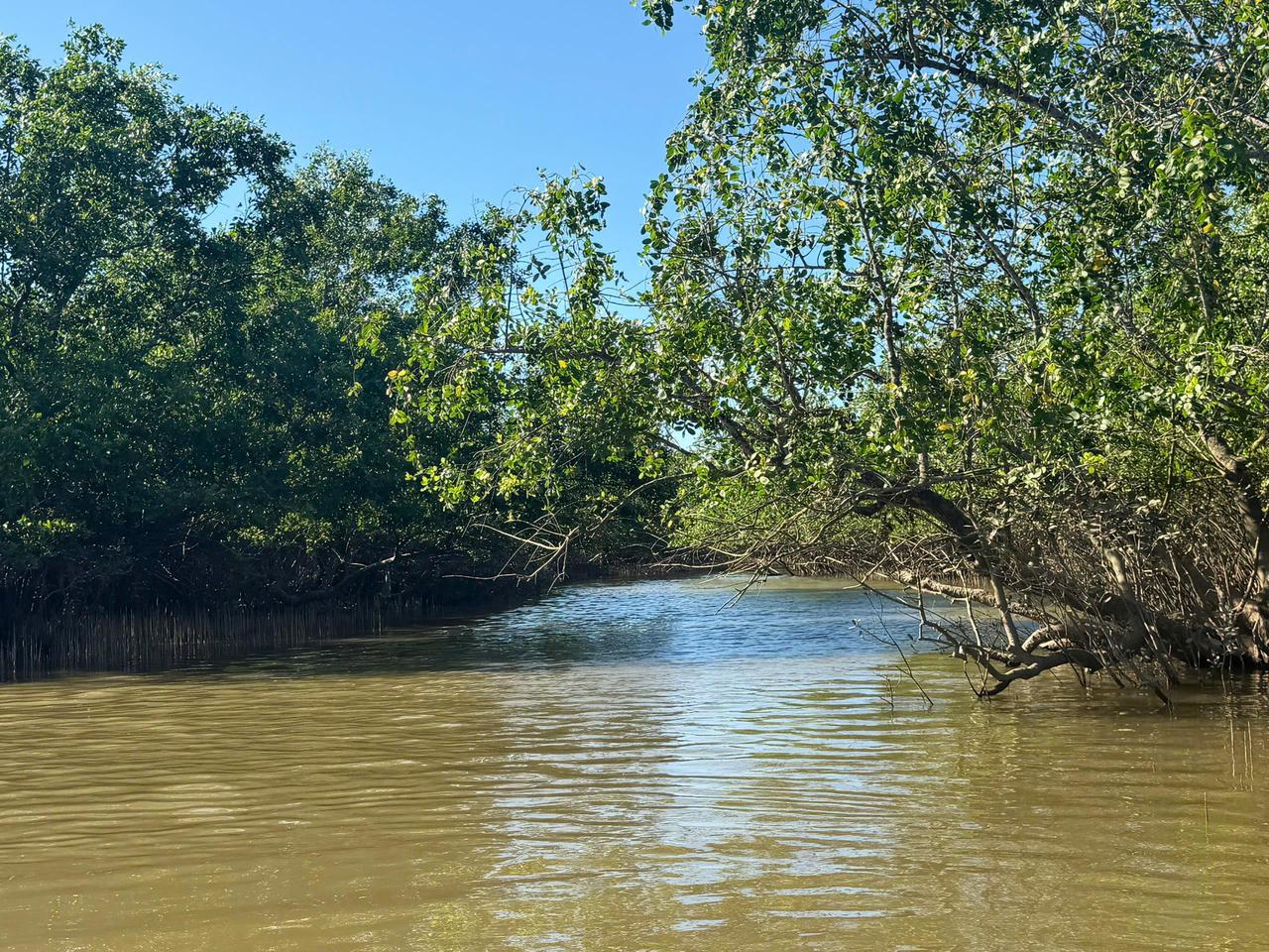
A study conducted in Xuan Thuy National Park combined field survey data with Sentinel-1 and Sentinel-2 remote sensing data and machine learning algorithms to identify and model the spatial distribution of mangrove species composition across the forest area. The results showed that Kandelia obovata (Trang) and assemblages containing K. obovata accounted for most of the mangrove forest area, while demonstrating the potential of multi-sensor remote sensing data for monitoring species distribution.

As digital transformation becomes a new driver of development, Vietnamese researchers have proposed a planning information system model that applies Geographic Information Systems (GIS) and artificial intelligence (AI) in Vinh Long Province. The research contributes to modernizing planning administration while introducing a new approach to digital government and data-driven governance in Viet Nam.

Using waste ethylene-vinyl acetate (EVA) shoe soles and vulcanized rubber—materials traditionally considered difficult to recycle—a research team from the School of Materials Science and Engineering at Hanoi University of Science and Technology has successfully developed a fully recycled composite material, creating potential new applications in green manufacturing and sustainable industrial production. The study not only contributes to addressing industrial waste challenges but also highlights Vietnam’s growing research and innovation capacity in sustainable materials and the circular economy.

The research project entitled “Development of a suitability map for Arabica coffee cultivation on sloping land in Dien Bien province using remote sensing data, GIS technology, and the analytic hierarchy process (AHP)” conducted by Dinh Xuan Hung, Bui Tuan Hai, and Nguyen Ngoc Sang of the Institute of Water Resources Planning represents a scientifically and practically significant study in the context of ongoing agricultural restructuring toward sustainable production systems that are better adapted to natural conditions and capable of utilizing land resources more efficiently in Viet Nam’s Northern midlands and mountainous region.

Intensive shrimp farming generates substantial economic benefits but also exerts increasing pressure on aquatic environments, particularly through wastewater rich in organic matter and toxic byproducts generated during farming operations. In the context where many shrimp farms still lack appropriate wastewater treatment systems, a research team from Can Tho University and Toan Viet Technological Environment Company Limited conducted an experimental study to assess the potential use of fishing nets—a readily available, low-cost material—as a filter material for biological treatment of wastewater from intensive shrimp ponds.