


 Steep terrain, concentrated heavy rainfall, and the increasingly evident impacts of climate change are placing Son La province’s land resources under growing pressure from soil erosion. By applying Geographic Information Systems (GIS) and the Revised Universal Soil Loss Equation (RUSLE), a research team comprising Tran Xuan Bien, Nguyen Van Huong, Luu Thuy Duong, and Tran Xuan Mien from the Hanoi University of Natural Resources and Environment and the Hanoi University of Mining and Geology has conducted a comprehensive study to assess the extent, severity, and spatial distribution of rainfall-induced soil erosion across the province. The findings offer an important scientific basis for land resource management and the formulation of sustainable development solutions in Son La.
Rainfall-induced soil erosion in Son La: Natural vulnerability and land-use pressures
Son La is among the mountainous provinces with the most complex natural conditions in Viet Nam’s Northwest region. The terrain is predominantly high and strongly dissected, with an average elevation of approximately 600–700 meters above sea level, characterized by steep slopes and narrow valleys. Agricultural land is fragmented and largely distributed on hillsides and mountain slopes, while areas with slopes below 25 degrees account for less than 15 percent of the province’s natural area.
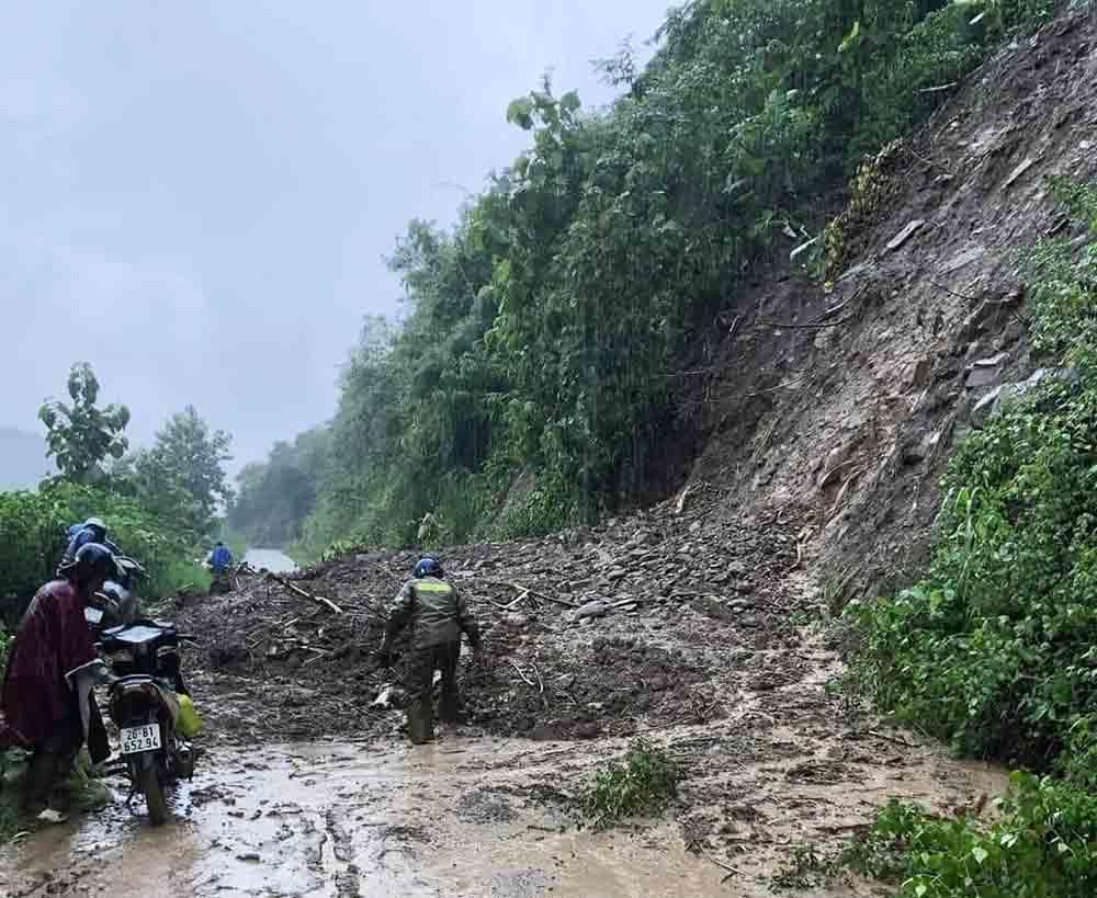
In addition to topography, rainfall regime exerts substantial pressure on land resources. Son La has a climate with two distinct seasons, including a rainy season marked by high precipitation concentrated over a relatively short period. Average annual rainfall ranges from 1,219 to 1,987 mm and tends to increase from the southwest toward the northeast. In recent years, under the influence of climate change, extreme rainfall events have occurred more frequently, triggering flash floods, landslides, and soil erosion across river basins, from major rivers to small streams and narrow valleys.
In this context, rainfall-induced soil erosion is no longer an isolated natural process but has emerged as a significant environmental, economic, and social concern. The removal of nutrient-rich topsoil degrades soil quality, directly affects crop productivity, and contributes to sedimentation in rivers and reservoirs, thereby increasing the risk of secondary natural hazards. For a province where livelihoods remain closely tied to agriculture on sloping land, a systematic assessment of rainfall-induced soil erosion is an urgent requirement—not only for land resource management, but also for informed and sustainable policy decision-making.
Assessing soil erosion using GIS and RUSLE: Data, factors, and methods
To quantify rainfall-induced soil erosion across the entire province, the research team adopted an approach based on the RUSLE integrated with GIS. This method is widely applied in soil erosion studies, as it allows the simultaneous integration of multiple natural and land-use factors within a spatial framework.
Under the RUSLE model, average annual soil loss (A, measured in tons per hectare per year) is calculated as the product of five factors: rainfall erosivity (R), soil erodibility (K), topographic factor reflecting slope length and steepness (LS), cover-management factor (C), and support practice factor (P). Each factor represents a different group of influences, ranging from climatic conditions and soil properties to land use and conservation practices.
In this study, each RUSLE factor was constructed as a thematic map layer. The rainfall erosivity factor (R) was calculated using long-term average rainfall data from meteorological stations influencing the province, applying formulas appropriate for northern mountainous regions. The soil erodibility factor (K) was derived from soil maps and key physical and chemical soil properties. The topographic factor (LS) was generated from a Digital Elevation Model (DEM), highlighting the decisive role of slope and slope length in erosion processes. Meanwhile, the cover-management (C) and support practice (P) factors were determined based on current land use, vegetation cover, and actual farming practices, supported by field surveys conducted at 523 locations across the province.
By overlaying and processing these data layers using ArcGIS software, the study transformed disparate datasets into a coherent spatial representation of rainfall-induced soil erosion. This approach not only quantifies erosion intensity but also identifies the location and extent of affected areas, providing a robust scientific foundation for erosion risk zoning and land management planning tailored to Son La’s specific conditions.
Developing a province-wide soil erosion map through GIS integration
Building on the RUSLE framework, the study developed a comprehensive set of factor maps and integrated them within a GIS environment—an essential step in translating scattered environmental parameters into a practical decision-support tool for land and environmental management.
Meteorological, soil, topographic, and land-use data were standardized and processed using ArcGIS 9.3, with MapInfo and Excel supporting statistical analysis and data aggregation. The rainfall erosivity factor (R) was spatially interpolated from long-term rainfall data, revealing clear variations in rainfall intensity among sub-regions of the province. The soil erodibility factor (K) showed differentiation by soil type and land-use status, with upland fields, newly planted forests, and areas converted from forest to annual crops exhibiting greater susceptibility to erosion.
Notably, the topographic factor (LS), which reflects slope steepness and slope length, demonstrated the dominant influence of mountainous terrain on soil erosion in Son La. Areas with slopes exceeding 15 degrees—concentrated in districts such as Song Ma, Sop Cop, Bac Yen, and Phu Yen—exhibited high LS values, indicating a heightened risk of erosion during heavy rainfall events. In contrast, the C and P factors underscored the regulatory role of human activities, from maintaining vegetation cover to applying soil conservation practices.
Overlaying the R, K, LS, C, and P factor maps produced a rainfall-induced soil erosion map for the entire province. Beyond its scientific value, this map functions as a form of “early warning” tool, enabling the identification of high-risk areas and supporting the integration of soil protection considerations into land-use planning, agricultural development strategies, and disaster risk reduction efforts.
Extent and severity ofsSoil erosion: Key findings and hotspot areas
Analysis of the rainfall-induced soil erosion map indicates that, out of a total surveyed area of 1,264,068 hectares in Son La province, approximately 719,782 hectares—equivalent to 56.94 percent—are affected by soil erosion at varying levels. This figure highlights the substantial vulnerability of the province’s land resources under current natural and land-use conditions.
Areas classified as experiencing no erosion cover 544,286 hectares, accounting for 43.06 percent of the surveyed area. Notably, all paddy land and land under perennial crops fall within this category, underscoring the protective role of flat terrain and stable vegetation cover.
By contrast, areas subject to severe erosion total 408,674 hectares, representing 32.33 percent of the surveyed area. These are concentrated primarily in mountainous districts characterized by steep slopes and high rainfall intensity. Major erosion hotspots include Song Ma district (41.96 percent of the province’s severely eroded area), Sop Cop (40.38 percent), and Bac Yen (34.26 percent), while Son La city accounts for only about 0.85 percent.
At the sub-regional scale, the highland and Viet Nam–Lao border areas experience the greatest pressure, with 251,997 hectares of severely eroded land—equivalent to 37.78 percent of the sub-region’s surveyed area. The Da River sub-region records 80,443 hectares (28.85 percent), while areas along National Highway 6 account for 76,234 hectares (23.95 percent).
Moderate erosion affects 157,218 hectares (12.44 percent), primarily in districts such as Phu Yen, Thuan Chau, and Moc Chau Town. Slight erosion covers 153,890 hectares, or 12.17 percent, distributed more sporadically but still concentrated in highland and border areas.
These findings not only depict current erosion conditions but also point to clear policy priorities: resources should be focused on areas experiencing severe and moderate erosion, particularly upland fields, unused land, and production forests on steep terrain. The use of GIS to precisely identify erosion hotspots thus plays a practical role in targeting interventions and enhancing the effectiveness of soil conservation and restoration programs in Son La.
Linking soil erosion with land use, livelihoods, and environmental risks
The analysis shows that rainfall-induced soil erosion in Son La is not randomly distributed, but closely linked to land-use types and the ways in which humans interact with the natural landscape. Among severely eroded areas, the largest shares occur on unused land (222,358 hectares) and upland fields cultivating annual crops such as maize and cassava (179,272 hectares). These land types typically have low vegetation cover, are located on steep slopes, and lack adequate soil conservation measures.
In contrast, severe erosion is virtually absent on paddy land, perennial crop land, and protection forests. This highlights the decisive role of stable vegetation cover, relatively flat terrain, or well-adapted land modification in reducing soil loss. Moderate erosion is mainly distributed across agricultural production land (77,666 hectares) and forestry land (57,206 hectares), reflecting increasing vulnerability in areas under pressure from land-use conversion.
These patterns confirm that soil erosion is not merely a natural issue, but a direct consequence of development choices and livelihood strategies. Expanding upland cultivation on steep slopes and converting forest land to annual crops without adequate soil protection measures have increased the risk of land degradation, leading to declining agricultural productivity, higher input costs, and greater vulnerability of mountainous communities to extreme weather events.
Beyond local impacts, soil erosion also generates wider environmental consequences. Eroded soil contributes to sedimentation in rivers and reservoirs, reducing water storage capacity and increasing the risk of localized flooding and flash floods. Prolonged soil degradation further diminishes soil biodiversity, disrupts ecosystem balance, and undermines the foundation of sustainable agricultural development—the primary livelihood base for much of Son La’s population.
From spatial evidence to policy action: Managing soil erosion risks in Son La
Moving beyond the description of current conditions, the rainfall-induced soil erosion map developed in this study offers important policy implications for land resource management in Son La. By clearly identifying areas of severe, moderate, and slight erosion, the approach enables a shift from generalized management to spatially targeted, risk-based interventions.
Areas experiencing severe erosion—particularly in highland zones and along the Viet Nam–Lao border—should be prioritized for intervention. Land-use policies in these regions need to limit the expansion of upland cultivation on steep slopes while strengthening soil restoration and protection measures, including protection forest development, vegetation cover enhancement, assisted natural regeneration, and long-term stabilization of plant cover. Integrating erosion maps into provincial- and district-level land-use planning can help avoid high-risk land conversion decisions.
In areas of moderate erosion, policy efforts should focus on adjusting farming practices. Measures such as contour farming, terracing, retaining crop residues after harvest, and applying appropriate cover crops can significantly reduce soil loss without disrupting local livelihoods.
From a longer-term perspective, the study demonstrates that GIS-based soil erosion assessment can serve as a foundational tool for land resource management under climate change. When regularly updated with meteorological, land-use, and vegetation data, erosion maps can support not only current assessments but also trend analysis and forecasting, enabling more proactive risk prevention and climate adaptation.
Beyond Son La, this approach offers a valuable reference for other mountainous provinces, underscoring the importance of spatial data and scientific evidence as a basis for policy formulation. By doing so, land and environmental management can gradually shift from reactive responses to a more proactive and sustainable approach to managing natural hazard and land degradation risks.

As digital transformation becomes a new driver of development, Vietnamese researchers have proposed a planning information system model that applies Geographic Information Systems (GIS) and artificial intelligence (AI) in Vinh Long Province. The research contributes to modernizing planning administration while introducing a new approach to digital government and data-driven governance in Viet Nam.

Using waste ethylene-vinyl acetate (EVA) shoe soles and vulcanized rubber—materials traditionally considered difficult to recycle—a research team from the School of Materials Science and Engineering at Hanoi University of Science and Technology has successfully developed a fully recycled composite material, creating potential new applications in green manufacturing and sustainable industrial production. The study not only contributes to addressing industrial waste challenges but also highlights Vietnam’s growing research and innovation capacity in sustainable materials and the circular economy.
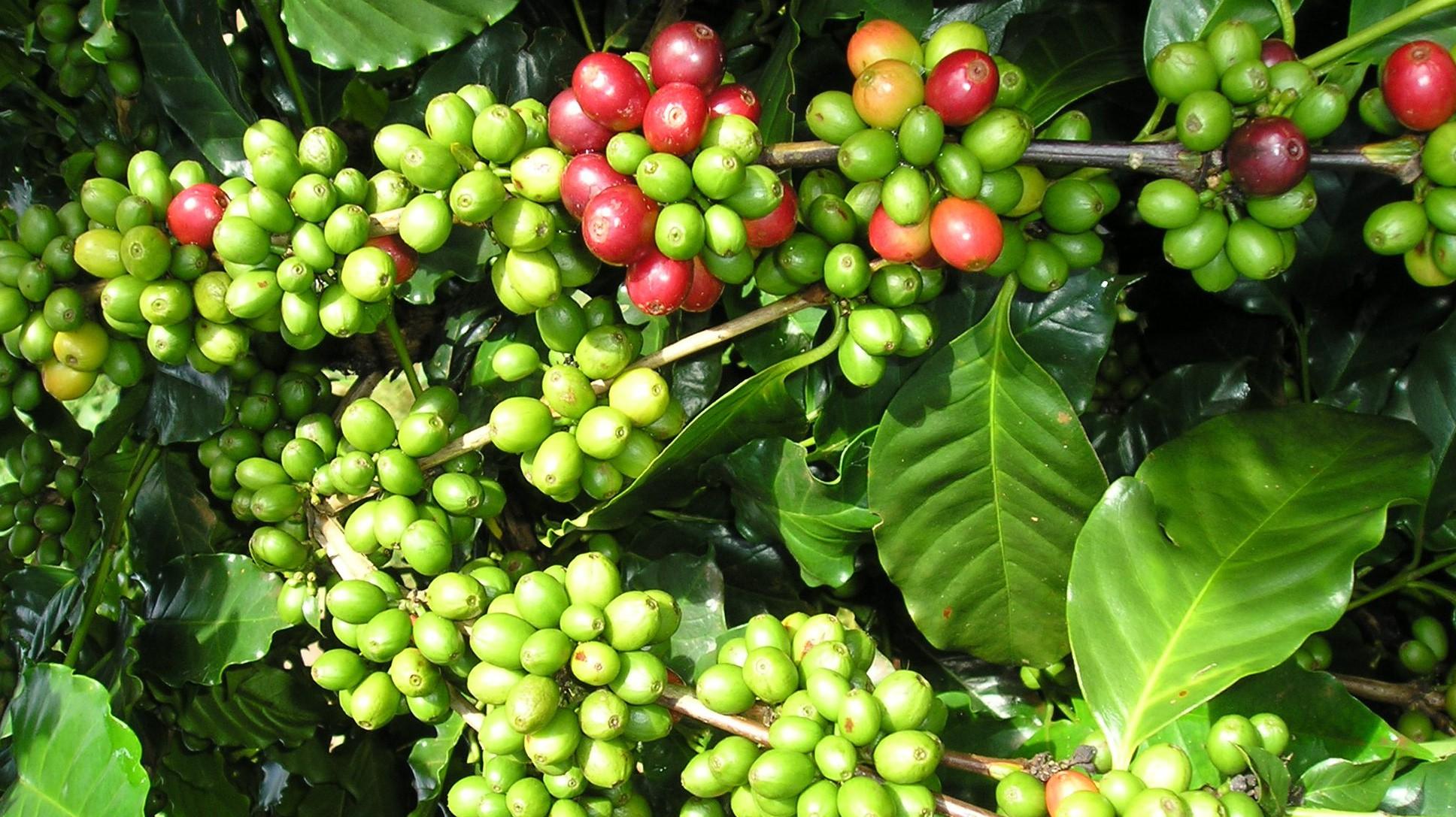
The research project entitled “Development of a suitability map for Arabica coffee cultivation on sloping land in Dien Bien province using remote sensing data, GIS technology, and the analytic hierarchy process (AHP)” conducted by Dinh Xuan Hung, Bui Tuan Hai, and Nguyen Ngoc Sang of the Institute of Water Resources Planning represents a scientifically and practically significant study in the context of ongoing agricultural restructuring toward sustainable production systems that are better adapted to natural conditions and capable of utilizing land resources more efficiently in Viet Nam’s Northern midlands and mountainous region.
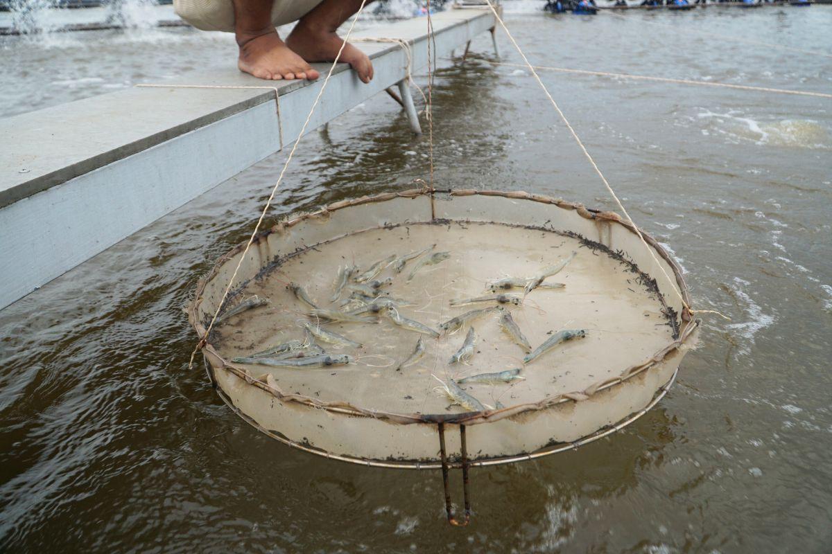
Intensive shrimp farming generates substantial economic benefits but also exerts increasing pressure on aquatic environments, particularly through wastewater rich in organic matter and toxic byproducts generated during farming operations. In the context where many shrimp farms still lack appropriate wastewater treatment systems, a research team from Can Tho University and Toan Viet Technological Environment Company Limited conducted an experimental study to assess the potential use of fishing nets—a readily available, low-cost material—as a filter material for biological treatment of wastewater from intensive shrimp ponds.
As floods become increasingly complex and extreme in Viet Nam’s North Central region, the demand for an early warning system that is reliable, fast to operate, and suitable for local-level application has become more urgent than ever. A research team from the Vietnam Academy for Water Resources—including Nguyen Thanh Hung, Vu Dinh Cuong, Trieu Quang Quan, and Nguyen Anh Hung—has developed an integrated technological solution that combines flood and inundation forecasting with modern communication tools. The study aims not only to enhance forecasting capacity but also to ensure that warning information reaches the right people at the right time under emergency flood conditions.