20/06/2026
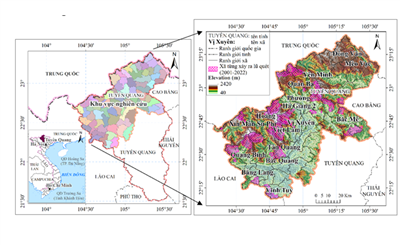
Flash floods in Vietnam’s northern mountains are not only tallied in annual disaster statistics, they shape the land, livelihoods, and planning decisions across entire districts. As climate change intensifies extreme rainfall, the demand for reliable and accessible hazard maps becomes urgent. A research team from the Institute of Mechanics, Vietnam Academy of Science and Technology (VAST) has demonstrated that Geospatial Artificial Intelligence (GeoAI) can meet this demand, producing high-precision, data-driven maps of flash flood risk for the northern communes of Tuyen Quang province, an area once part of Ha Giang’s rugged highlands.