




 Urban flooding is increasingly influenced by a combination of heavy rainfall, river flows, tides, water-storage capacity, land use and urban spatial planning. At the international conference on “Urban flood and river basin management in the context of climate change: Japan’s experience and recommendations for Viet Nam”, held in Hanoi on August 21, Deputy Minister of Agriculture and Environment Le Cong Thanh said the issue should be addressed as part of integrated water resources management, urban planning and disaster risk governance, rather than being treated solely as a drainage problem within individual cities.
Urban flooding must be addressed at the river basin level
A flooded street may be a highly localized problem, but its causes do not necessarily originate in the drainage system serving that street. Rainfall, flows from upstream areas, river levels, tides, the storage capacity of a river basin and changes in land use can all affect a city’s drainage capacity.
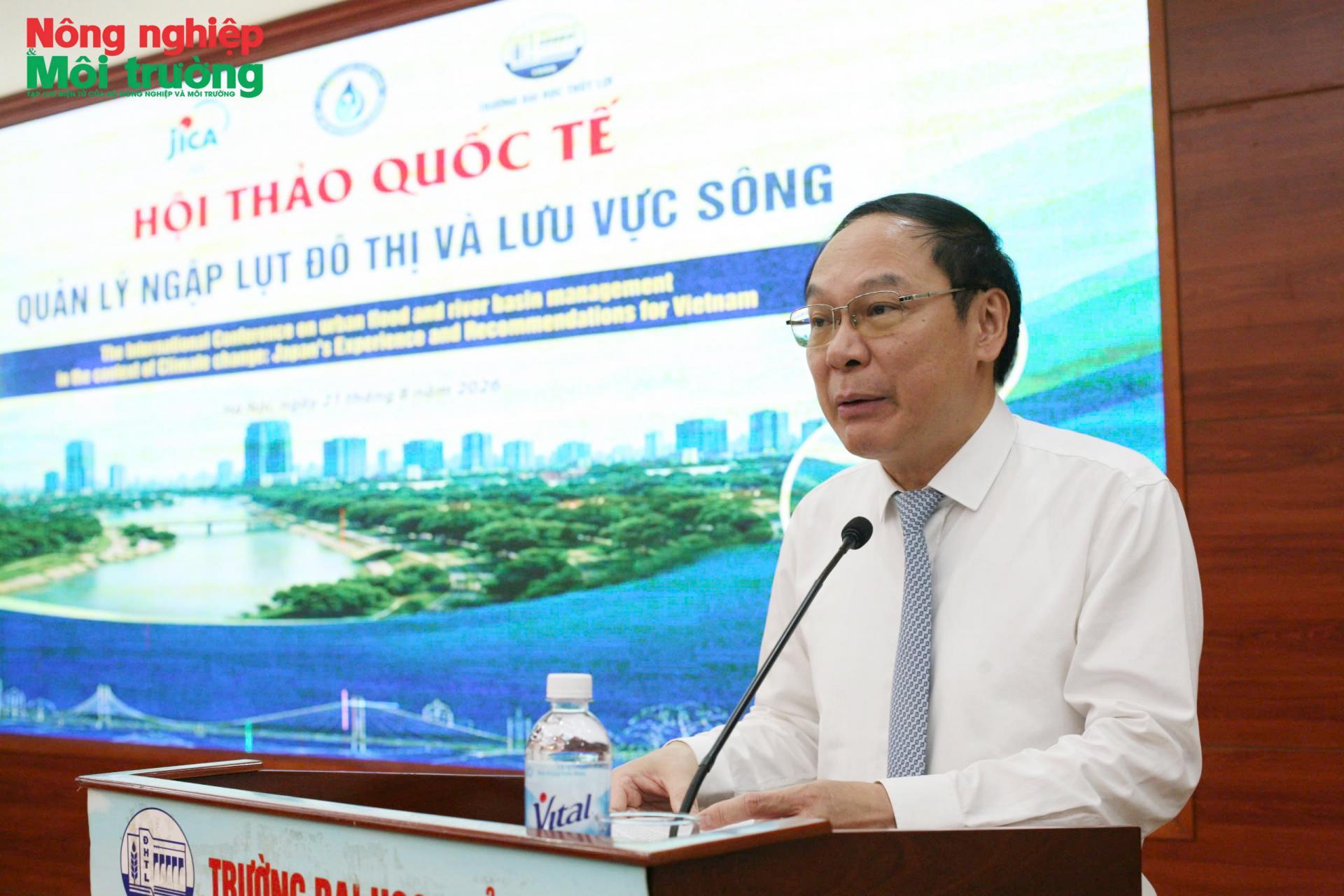
That is why Deputy Minister Le Cong Thanh said urban flooding could no longer be viewed simply as a drainage issue within individual cities. Hydrological conditions and urban spatial planning are closely interconnected, he said, so flood management needs to be considered alongside water resources management, urban planning and disaster risk governance.
Flooding mechanisms vary considerably from one locality to another. In mountainous cities such as Thai Nguyen, Da Lat and Lao Cai, heavy rainfall can coincide with river flooding. In many lowland cities, flooding is primarily associated with rainfall and drainage capacity. Coastal cities such as Hue, Da Nang, Ho Chi Minh City and Can Tho, as well as other urban areas in the Mekong Delta, can face a combination of rainfall and tidal flooding. In some areas, land subsidence further complicates the problem.
Data presented at the conference showed that Vietnam recorded about 397 urban flood locations nationwide in 2024, affecting a total area of roughly 925 hectares. The figures point to a problem that cannot be addressed through a single model. Even similar amounts of rainfall can have very different impacts depending on an urban area’s position within a river basin, the capacity of rivers and drainage systems to receive and convey water, and changes in the urban landscape.
A 2025 rainfall event in Thai Nguyen illustrates the interaction of these factors. Rainfall reached about 230–500 mm over two days in some areas, causing flooding as the Cau River also rose and overflowed into the urban area. In Da Lat, rapid urbanization and agricultural development have increased surface runoff. In Can Tho, changes in river morphology associated with economic development may allow tidal waters to propagate farther inland, placing additional pressure on drainage systems.
These differences make it necessary to tailor flood-management measures to the characteristics of each river basin rather than applying a single model to all cities. At the same time, cities cannot be considered separately from the wider water system. Land-use planning, construction, drainage networks, rivers, lakes and areas capable of retaining water all interact and need to be considered as part of the same system.
Deputy Minister Le Cong Thanh placed this approach within the broader shift toward disaster risk governance. Citing Notice No. 117, dated July 4, 2026, issued by the Office of the Party Central Committee, he highlighted the need to move from a primarily response-based approach to risk governance; from dealing with the aftermath to prevention and preparedness well in advance; and from relying mainly on experience to using data, science, technology and law as the basis for management. Prevention, he said, needs to be incorporated into planning, investment, construction standards, floodways, river and stream management, urban drainage and early warning.
Conclusion No. 75, dated July 28, 2026, on environmental protection and proactive responses to climate change, likewise calls for a shift from fragmented management by sector and administrative boundaries to integrated, intersectoral and interregional governance based on data and risk levels. The approach has direct implications for urban flood management because water does not follow administrative boundaries, and measures taken in one area can affect drainage and water-storage capacity elsewhere.
Urban planning must account for water storage and drainage capacity
When flooding is influenced by the wider water system, urban planning cannot focus solely on moving water out of built-up areas as quickly as possible. Cities also need spaces where water can be retained, regulated and dispersed during heavy rainfall.
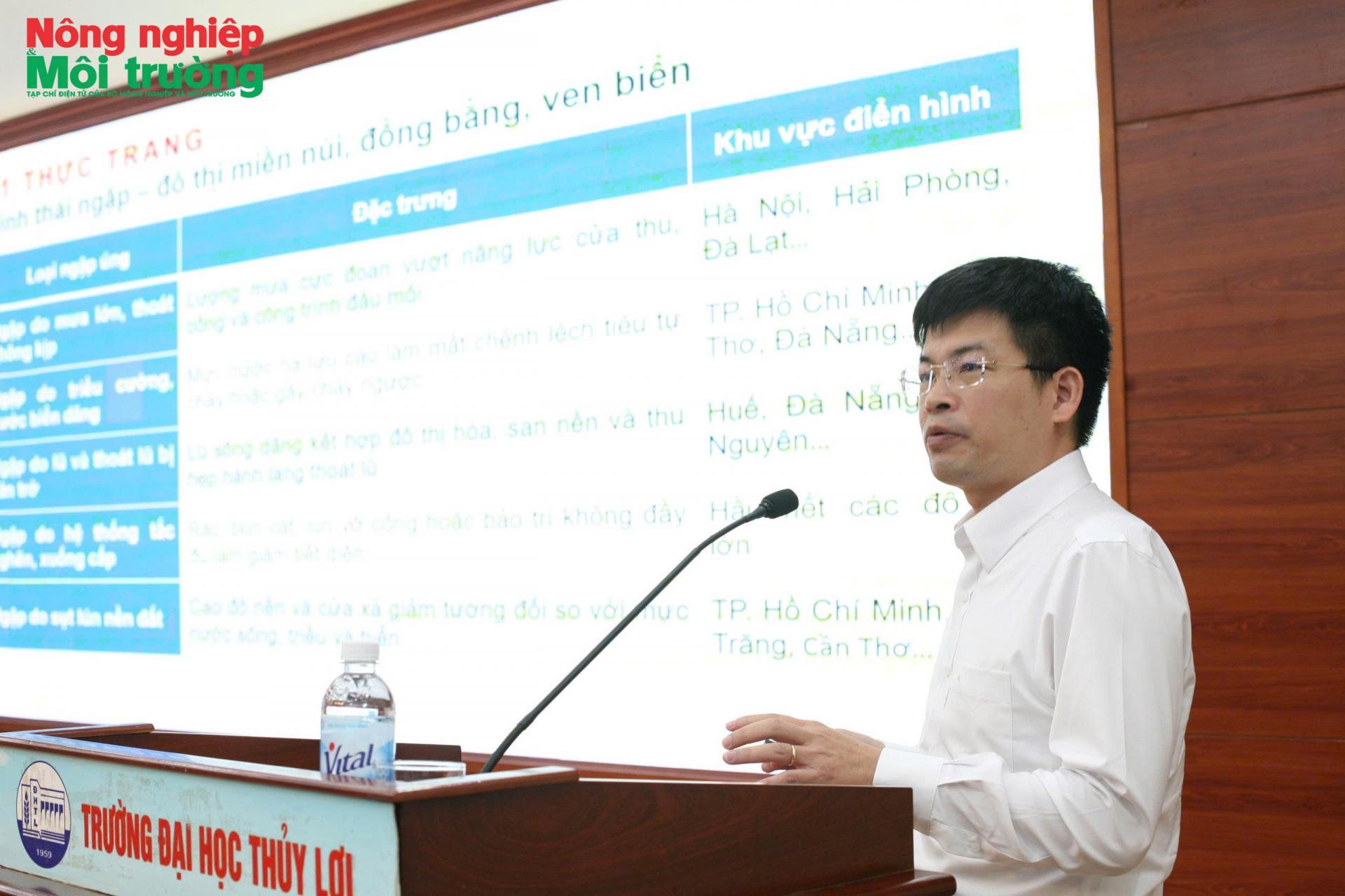
Hanoi illustrates this challenge. Associate Professor Dang Minh Hai, Deputy Dean of the Faculty of Water Resources Engineering at Thuyloi University, said flooding in Hanoi is mainly rainfall-driven. Much of the city center lies within the Red River dike system and is therefore less directly exposed to river flooding, but drainage remains heavily dependent on the capacity of the urban drainage system. The city’s drainage master plan, issued in 2013, has provided a basis for numerous projects, but the capacity of pumping stations and the area of detention ponds currently amount to only about 30% of the level required under the plan.
Another concern is that some of the design assumptions used in the earlier plan no longer fully reflect current rainfall conditions. The Hanoi drainage plan was based on a design rainfall of about 310 mm over two days, while several recent heavy-rain events have exceeded that level, overloading the system and causing flooding at multiple locations. Associate Professor Dang Minh Hai said the city needs to reassess drainage capacity to distinguish flooding that occurs within the system’s design conditions from flooding caused by events exceeding the design frequency. Such a distinction is important not only for infrastructure planning but also for assessing risk and helping communities prepare and adapt.
The issue, therefore, is not simply how many more kilometers of drainage pipes or how much additional pumping capacity are needed. Nearly 15 years after the 2013 plan was issued, many of its underlying datasets have changed, while the urban structure and rainfall conditions have also evolved. Reviewing the plan on the basis of updated data should go hand in hand with investment in drainage infrastructure, including pipes, detention ponds and pumping stations, particularly those discharging into the Red and Nhue rivers.
Deputy Minister Le Cong Thanh’s emphasis on putting prevention “one step ahead” underscores the link between planning and risk management. Prevention does not begin only when heavy rainfall is forecast. It needs to be built into decisions on urban development, construction standards, floodways and drainage systems from the outset. In that sense, flood resilience needs to be treated as part of urban planning and development before new projects are built.
Detention ponds, parks, schools and public spaces that can temporarily retain water can therefore serve not only as urban amenities but also as components of the city’s water-management system. Measures such as underground storage tanks and sustainable drainage systems may also be considered where appropriate, although investment decisions should take into account population density, asset values and local socio-economic conditions.
Making room for water does not mean restricting urban development. It means anticipating where water will go, where it can be retained and how it can be drained when rainfall exceeds normal conditions. This is also consistent with the direction outlined by Deputy Minister Le Cong Thanh from Conclusion No. 75, which calls for planning and development to respect ecological limits and environmental carrying capacity, while giving greater consideration to nature-based solutions, green infrastructure and infrastructure capable of withstanding flooding, storms and other climate-related impacts.
A multilayered approach to urban flood management
Japan’s experience shows that flood management cannot rely on a single group of structures or one part of the drainage system. As urbanization progressed, Japan also faced heavy rainfall that overwhelmed drainage systems, while low-lying and coastal cities had to contend with the combined effects of rivers, tides and changing climate conditions. Its approach has consequently placed greater emphasis on connecting urban areas with river systems and infrastructure across the basin.
At the conference, Japanese experts described a multilayered approach combining several types of measures. The first involves flow control and improving river conveyance capacity through measures such as river improvement, dredging and widening where appropriate. The second focuses on water storage through detention ponds, reservoirs and other spaces capable of temporarily holding rainfall. When rainfall exceeds infrastructure capacity, preparedness and response measures are also needed, including flood hazard maps, identification of high-risk areas and evacuation plans.
A key feature of this approach is that the measures are designed to work together. Urban drainage systems need to be connected with rivers, dikes and water infrastructure, while urban development needs to account for its potential to increase surface runoff. Development projects, particularly privately funded ones, can also incorporate measures to retain part of their stormwater onsite, reducing the volume of water entering drainage networks over a short period.
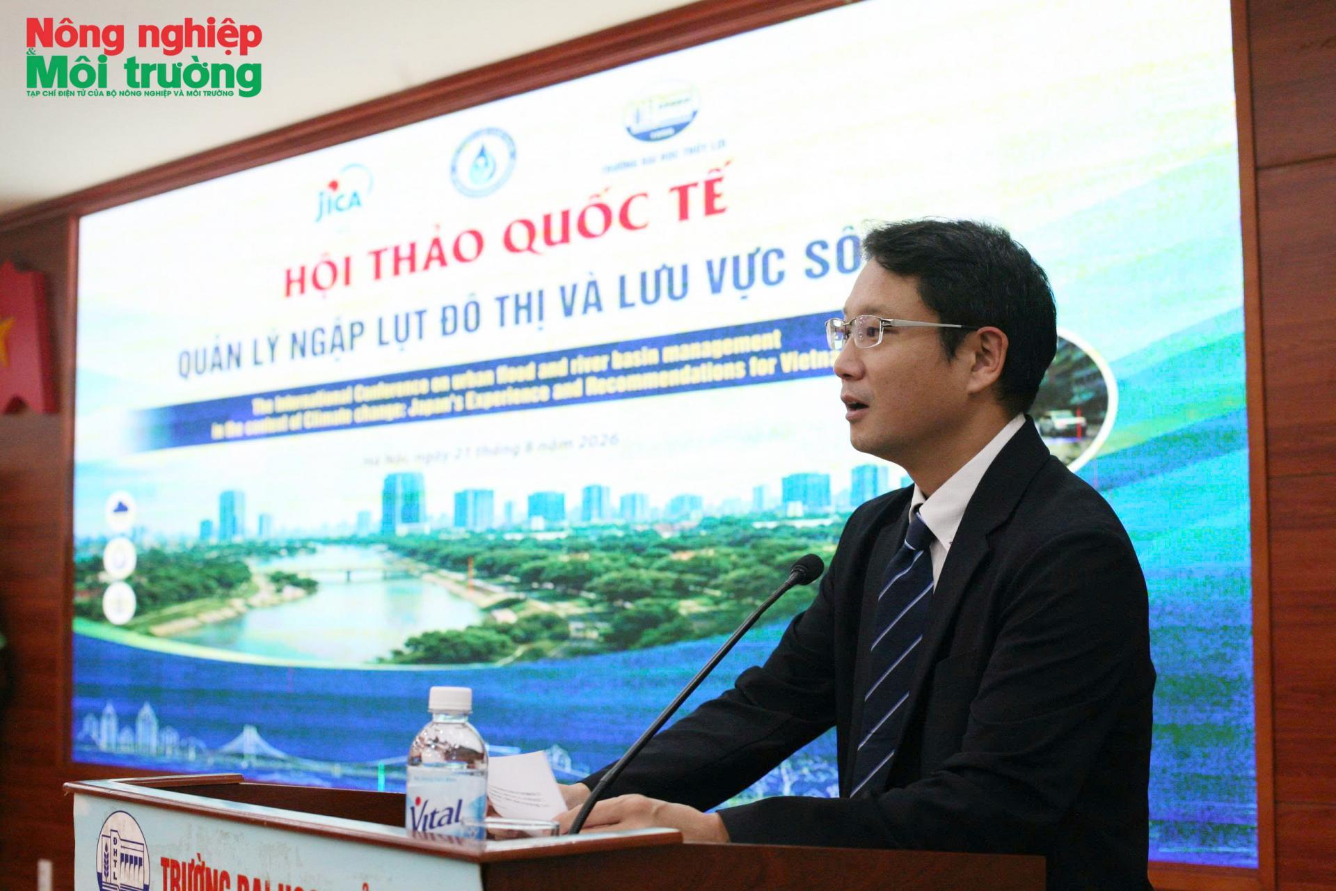
Kobayashi Kenichi, Deputy Chief Representative of the Japan International Cooperation Agency (JICA) in Viet Nam, said Japan had faced similar challenges in managing urban and river-basin flooding during its urbanization process. JICA experts also shared experience from Osaka, where flood management has been developed at the basin level, with local governments playing a direct role in coordinating and implementing flood mitigation measures.
The multilayered approach also changes the way flood-management outcomes are viewed. When extreme rainfall exceeds the design capacity of infrastructure, the practical goal is not necessarily to eliminate all flooding, but to limit its depth and extent, shorten the duration of inundation and reduce damage to people and economic activity. This provides a basis for combining infrastructure investment with spatial planning, flow management and preparedness.
For Viet Nam, the value of Japan’s experience lies more in the way different elements are organized as a system than in replicating a specific model. Hydrological conditions, terrain and the pace of urbanization vary widely among localities, so measures need to be selected according to the causes of flooding and each city’s position within its river basin.
Integrated data for proactive flood risk governance
If infrastructure is the physical foundation of flood management, data is increasingly becoming the basis for operating that system. When heavy rainfall develops rapidly and cannot be forecast precisely at every location, advance information on rainfall, water levels, flood propagation and the risk of infrastructure overload can directly inform operational decisions and warnings.
Thuyloi University is conducting research on flood mapping, forecasting models, hydraulic regulation and disaster risk assessment for urban areas and regions exposed to flooding. The university is also studying the use of artificial intelligence, big data and remote sensing for real-time flood warning. Such technologies can provide more information for decision-makers, but their effectiveness depends first on the quality of the underlying data and the ability to connect information from different sources.
This was also among the issues raised at the workshop. Data on rainfall, water levels, infrastructure, topography, land use and population are often held by different agencies and levels of government. When these datasets are not standardized or cannot be shared easily, it becomes more difficult to build a consistent picture of flood risk. Alongside investment in equipment and technology, attention therefore needs to be given to data-sharing mechanisms and interoperability between systems.
Prof. Dr. Nguyen Trung Viet, President of Thuyloi University, said management solutions and policies can only be effective when they are grounded in science, reliable data and qualified human resources. Flood hazard maps and forecasting models, in this context, can serve not only for warnings during heavy rainfall but also for planning, investment decisions and the development of operating scenarios for flood-control infrastructure.
For 2026–2035, the priority should not simply be to add infrastructure at locations that frequently flood, but also to identify high-risk river basins and areas where resources should be concentrated. Updating risk maps, forecasting models and investment programs according to appropriate levels of protection would help align decisions more closely with actual conditions.
Connecting data with planning and infrastructure operations could gradually shift flood management from responding to individual flooded locations after heavy rain to identifying risks in advance and preparing measures before flooding occurs. Such an approach is consistent with the broader call for intersectoral and interregional coordination and greater use of science and technology in water resources management and disaster prevention.
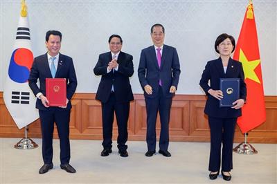
On July 2, 2024, Prime Minister Pham Minh Chinh and South Korean Prime Minister Han Duck Soo witnessed the signing of a Memorandum of Understanding (MoU) for cooperation in establishing an eco-industrial park project between the Vietnamese Ministry of Natural Resources and Environment and the South Korean Ministry of Environment, represented by Minister Dang Quoc Khanh and Minister Han Wha-jin.
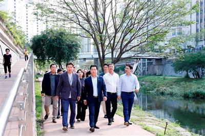
As part of the Vietnam-Korea environmental conference, Minister Dang Quoc Khanh visited the Cheonggyecheon stream—a symbol of Seoul's efforts to "revive the dead river".
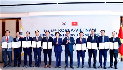
During the 16th Vietnam-Korea Environmental Ministers' Meeting, Vietnam's Minister of Natural Resources and Environment, Dang Quoc Khanh, and South Korea's Minister of Environment, Han Wha-jin, reached an agreement to implement comprehensive cooperation between the two ministries in the environmental sector.
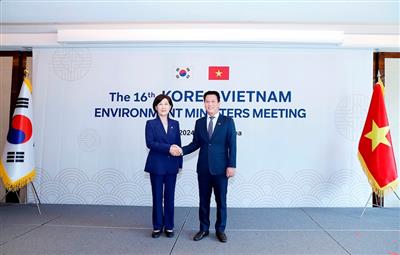
On July 1, the 16th Vietnam-Korea Environment Ministers' Meeting, presided over by Vietnamese Minister of Natural Resources and Environment Dang Quoc Khanh and Korean Minister of Environment Han Wha-jin, convened in Seoul, South Korea.
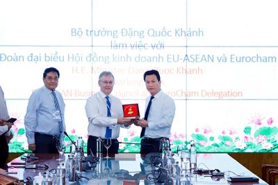
On June 27, Minister Dang Quoc Khanh received a delegation from the EU-ASEAN Business Council (EU-ABC) led by Mr. Noel Clehane, Vice Chairman of EU-ABC, and Mr. Jean-Jacques Bouflet, Vice Chairman of EuroCham Vietnam, along with representatives from several companies in the EU-ABC and EuroCham working groups. They discussed matters related to the Ministry of Natural Resources and Environment's (MONRE) areas of management.