


 In response to the increasingly evident impacts of climate change and sea level rise on coastal areas, a research team from Thanh Dong University and the Thai Nguyen University of Agriculture and Forestry has developed a sea level rise–related inundation risk database for the coastal zone of Thanh Hoa province. Based on digital elevation models (DEM), remote sensing data, and Representative Concentration Pathway (RCP) climate scenarios, the study provides a quantitative assessment of the projected increase in inundation risk over time, thereby clarifying potential impacts on coastal land use patterns at the time milestones of 2050, 2080, and 2100.
Sea level rise: A growing pressure on coastal land use
Over recent decades, climate change has generated increasingly pronounced impacts on coastal regions, which are typically characterized by low-lying topography, high population density, sensitive ecosystems, and intensive socio-economic activities. According to assessments by the Intergovernmental Panel on Climate Change (IPCC), global mean sea level has shown a continuous upward trend, with projections indicating a rise ranging from approximately 0.5 m to more than 1 m by the end of the 21st century under scenarios without effective greenhouse gas emission reductions.
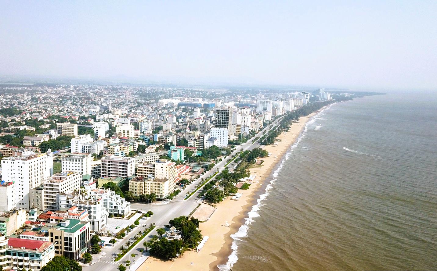
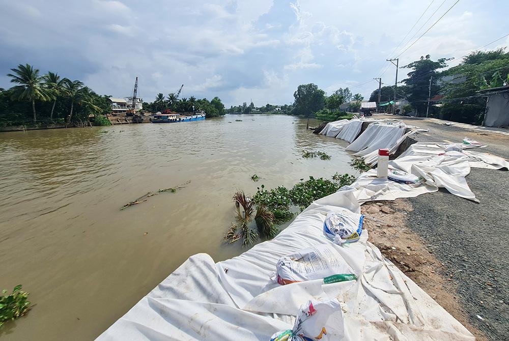
In Viet Nam, coastal zones are widely recognized as among the earliest and most directly affected areas by sea level rise. Thanh Hoa province, with its extensive coastline and low-elevation coastal terrain, has been identified as a locality with relatively high exposure. Many coastal areas of the province are distributed along river mouths, lagoons, and low-lying sandy plains, which are frequently subject to the combined effects of tides, storms, flooding, and saline intrusion.
However, land use planning and management in coastal areas have largely been based on current land use conditions and socio-economic development objectives, while climate change factors—particularly sea level rise—have not yet been fully or systematically integrated. This has increased the risk of adverse consequences such as residential flooding, agricultural productivity loss, coastal erosion, and degradation of coastal ecosystems.
Within this context, the development of a spatially explicit, updatable database on inundation risk caused by sea level rise is considered a necessary foundation to support more proactive land use management and planning in coastal areas.
Using geospatial data to map inundation risk
To address this practical need, the research adopted a geospatial data–based approach to construct a sea level rise inundation risk database for the coastal zone of Thanh Hoa province. The core of the study involved integrating multiple data sources—including digital elevation models, remote sensing data, and greenhouse gas emission scenarios—to simulate the spatial and temporal extent of inundation risk.
Specifically, the SRTM DEM with a spatial resolution of 30 m was used to identify low-elevation areas that are potentially vulnerable to sea level rise. Land use and land cover information was derived from the ESRI 10 m Annual Land Cover dataset, which is generated from Sentinel-2 satellite imagery using deep learning techniques and has an average accuracy exceeding 75%. This dataset was incorporated to assess the degree of impact of sea level rise on different land use types across the study area.
In addition, the study employed sea level rise scenarios for Viet Nam updated according to the RCP 2.6, RCP 4.5, and RCP 8.5 greenhouse gas emission pathways, based on published results from the IPCC and the Ministry of Natural Resources and Environment (now the Ministry of Agriculture and Environment). These scenarios were applied to the time horizons of 2050, 2080, and 2100 to reflect medium- and long-term trends in sea level change.
Through data processing, standardization, and overlay analysis conducted in GIS environments and Google Earth Engine, inundation risk maps and quantitative statistics were produced for the entire coastal area of Thanh Hoa province. This approach enables a spatially explicit representation of inundation risk while providing numerical estimates of impacts by administrative unit and land use category.
Projected sea level rise under different emission scenarios
To assess inundation risk associated with sea level rise, the study utilized climate scenarios representing different greenhouse gas emission trajectories, including RCP 2.6 (low emissions), RCP 4.5 (medium–low emissions), and RCP 8.5 (high emissions). These scenarios were developed based on updated global sea level rise projections by the IPCC and national sea level rise scenarios for Viet Nam.
Under these scenarios, sea level in the East Sea is projected to increase over time, with magnitudes strongly dependent on emission pathways. By 2050, sea level rise ranges from 23 cm under RCP 4.5 to 28 cm under RCP 8.5, with relatively small differences among scenarios, reflecting ocean system inertia and early-stage climate impacts.
Toward the end of the 21st century, inter-scenario differences become more pronounced. By 2100, sea level rise is projected to reach 46 cm under RCP 2.6, while under RCP 8.5 it increases to 77 cm, equivalent to 1.67 times the rise under the low-emission scenario. These results reflect the cumulative effects of greenhouse gas emissions and the strong dependence of sea level rise on global development and energy pathways.
The study notes that the applied scenarios consider only changes in mean sea level due to climate change and do not include other factors such as storm surge, monsoonal effects, tides, geological uplift or subsidence, or localized processes. Accordingly, the modeled results represent inundation risk under average sea level rise conditions and serve as a basis for assessing spatial and temporal trends.
Where inundation risk concentrates along Thanh Hoa’s coast
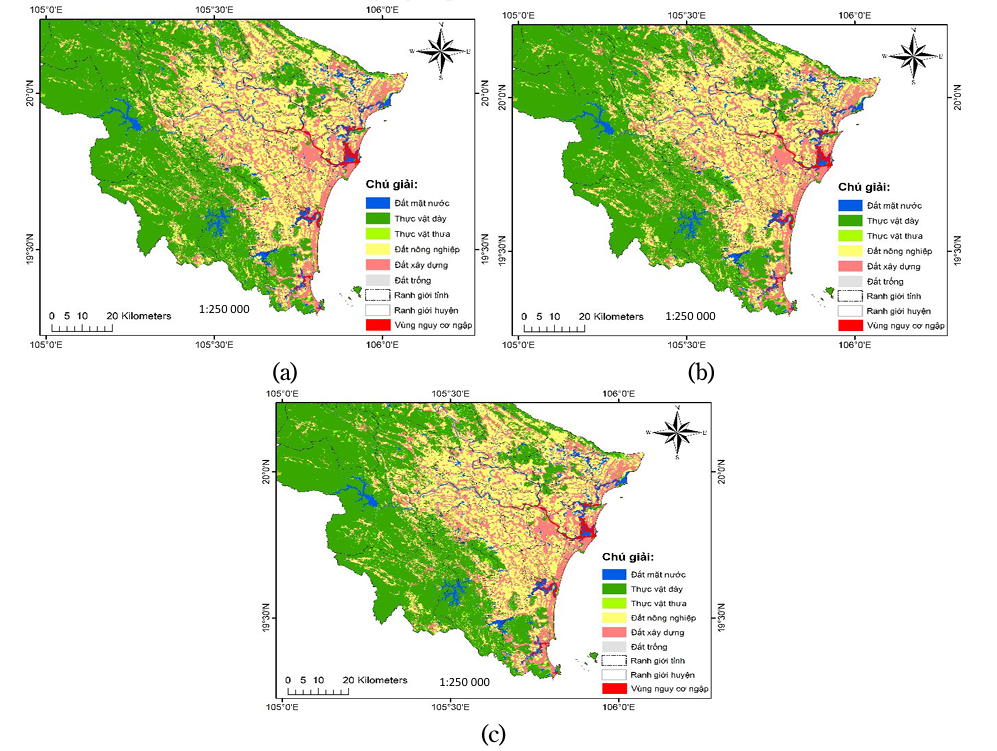
By integrating the digital elevation model, administrative boundaries, and sea level rise scenarios, the study produced a set of inundation risk maps for the coastal zone of Thanh Hoa province at the 2050, 2080, and 2100 time horizons. These maps enable visual identification of the spatial extent and severity of inundation risk under different emission scenarios.
The results indicate that areas with high inundation risk are mainly concentrated in coastal belts and river mouth zones, including Hoang Hoa, Hau Loc, Nga Son, and Nghi Son town (based on administrative boundaries prior to 1 July 2025). These areas are characterized by low elevation and proximity to the sea, rivers, and lagoon systems, and are frequently affected by tides and storm-related flooding.
Under RCP 2.6, inundation extent in 2050 remains relatively limited and scattered, primarily occurring in low-lying areas near river mouths and coastal plains. However, by 2100, even under low-emission conditions, coastal zones exhibit a noticeable expansion of areas exposed to inundation risk, affecting residential areas and agricultural land.
Under RCP 4.5, both the extent and intensity of inundation risk increase substantially. Maps for 2080 and 2100 show inland expansion of inundation-prone areas into coastal plains that host dense populations and socio-economic activities. The influence of sea level rise extends beyond immediate coastal margins along river corridors and low-lying inland areas.
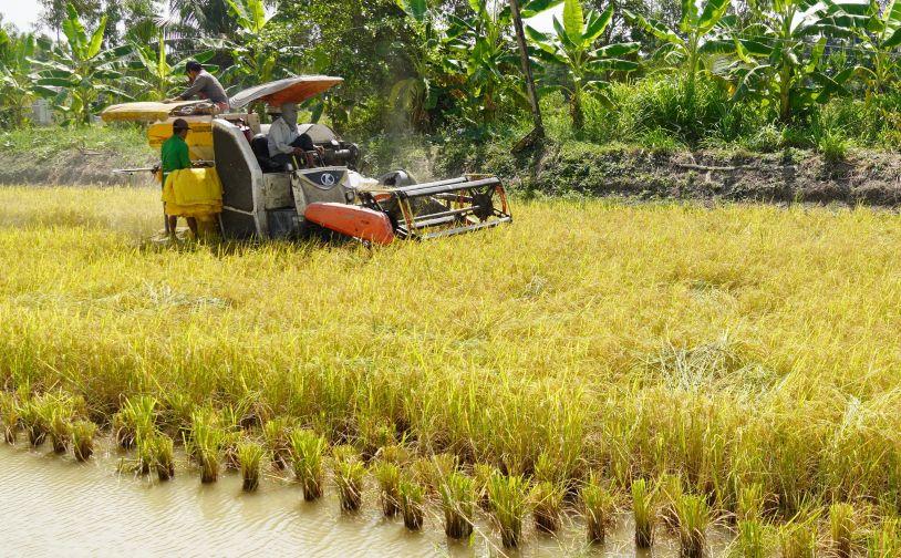
In contrast, RCP 8.5 indicates severe impacts beginning as early as mid-century. By 2050, many coastal areas already fall within high-risk zones, and by 2100, most of the coastal plain of Thanh Hoa province is identified as vulnerable to inundation, including rice-growing areas, aquaculture zones, and rural residential land. Portions of coastal protection forests and unused land are also affected, reflecting a pronounced spatial expansion of inundation risk under high-emission conditions.
How different land use types are affected
Statistical analysis of the inundation risk maps shows that the total area exposed to sea level rise–related inundation in the coastal zone of Thanh Hoa province increases over time and across emission scenarios. Under RCP 2.6, the total inundation-prone area increases from 6,971.17 ha in 2050 to 6,997.69 ha in 2100. Under RCP 8.5, the area rises from 6,972.43 ha to 8,933.40 ha over the same period, representing an increase of nearly 2,000 ha within 50 years.
At the administrative level, Hoang Hoa district consistently records the largest inundation-prone area across all scenarios and time horizons, ranging from 2,290.05 ha (RCP 2.6, 2050) to 2,946.33 ha (RCP 8.5, 2100). Nghi Son town also shows substantial exposure, with inundation areas increasing from 1,370.81 ha to 1,741.65 ha. Other localities, including Quang Xuong district, Thanh Hoa city, and Sam Son city, each exceed 500 ha of inundation-prone land under most medium- and high-emission scenarios.
By land use type, water surface areas are the most affected. Under RCP 2.6, inundated water surface areas range from 6,186.56 ha in 2050 to 6,207.43 ha in 2100, while under RCP 8.5, this area increases to 7,770.67 ha by 2100, reflecting expanding inundation in river mouths, lagoons, and low-lying coastal zones.
Agricultural land and built-up areas also show increasing inundation exposure over time and across scenarios. Under RCP 2.6, agricultural land affected by inundation reaches 380.03 ha by 2100, compared with 562.19 ha under RCP 8.5. Built-up land increases from 214 ha to 349.65 ha over the same period, indicating that inundation risk extends beyond natural areas into productive and residential spaces.
For vegetation cover, including dense and sparse vegetation, the total inundated area exceeds 150 ha by 2100 under RCP 8.5. jAlthough relatively small compared with other land use categories, these results indicate that coastal vegetation zones are also within the influence of sea level rise. Unused land shows an increase in inundated area from 68.21 ha (RCP 2.6, 2050) to more than 95.17 ha (RCP 8.5, 2100).
Providing scientific evidence for coastal land management
The modeled results provide a quantitative and spatially explicit depiction of the vulnerability of Thanh Hoa’s coastal zone to sea level rise under climate change. Through detailed mapping and statistical analysis by scenario, time horizon, administrative unit, and land use type, the study demonstrates clear spatial differentiation of inundation risk and a pronounced increase over time, particularly under medium- and high-emission scenarios.
The constructed database enables the identification of areas with high, medium, and low inundation risk, while also clarifying the varying levels of impact across different land use types, including water surfaces, agricultural land, built-up areas, and vegetation cover. The quantification of inundation-prone areas for the time horizons of 2050, 2080, and 2100 provides insight into the long-term spatial evolution of coastal areas under the influence of sea level rise
According to the research team, the developed inundation risk maps and associated quantitative statistics constitute scientific outputs that can serve as input information for land resource management and coastal spatial planning studies in the context of climate change. The integration of geospatial data, remote sensing, and climate scenarios enables comparative analysis across emission pathways and supports spatial and temporal risk assessment.
Overall, the study affirms the role of a sea level rise database as a scientific tool for clarifying the relationship between climate change and coastal land use, while providing a data foundation for subsequent research related to land management and spatial planning in coastal areas of Thanh Hoa province.
The Mekong Delta is one of the world’s most important deltaic systems, yet it is also among the regions most severely affected by coastal erosion, mangrove degradation, sea-level rise, land subsidence, and declining sediment supply. Against this backdrop, a study by Prof. Dr. Thieu Quang Tuan of the Faculty of Engineering, Thuyloi University proposes a scientifically grounded perspective: effective coastal protection and mangrove restoration must begin with a proper understanding of the natural dynamics governing muddy coasts and fine-grained sediment balance.
As riverbank erosion becomes increasingly severe in the Mekong Delta, many localities have begun piloting nature-based riverbank protection solutions that utilize locally available materials and minimize hard-engineering interventions in river flows. However, evaluating the effectiveness of these solutions remains challenging, particularly when international assessment frameworks do not fully align with the socio-ecological conditions of the delta region.

As organic farming and safe agricultural production gain momentum, botanical plant protection products are increasingly being viewed as a promising alternative to conventional chemical pesticides. Drawing on more than half a century of research, a review by Nguyen Thi Lan Huong, Dang Thi Thanh Le, and Vuong Dang Le Mai from Thuyloi University and University of Transport Technology highlights Viet Nam’s rich plant resources and their potential for developing a new generation of biological plant protection products.
The emergence of recombinant African swine fever virus (ASFV) strains derived from genotypes I and II (rASFV I/II) poses a new challenge to the effectiveness of currently available vaccines in Viet Nam. A preliminary study conducted in experimental pigs by Nguyen Van Diep, Nguyen Van Duc, Vu Xuan Dang, Nguyen Thi Ngoc, Do Phuc Tue, Tran Ngoc Tiep (AVAC Vietnam Joint Stock Company), and Pham Ngoc Doanh (Institute of Biology, Vietnam Academy of Science and Technology) shows that the AVAC ASF LIVE vaccine confers cross-protective efficacy against this strain, with outcomes influenced by vaccination regimen and challenge dose.
Following episodes of drought and saltwater intrusion that required restructuring agricultural production in coastal areas, rice–shrimp and shrimp monoculture systems were adopted as adaptive strategies. However, changes in farming practices are accompanied by shifts in agroecosystem structure.