




 Research by Vu Thi Thu Hien proposes integrating satellite positioning data with radar imagery to monitor land subsidence in the Vietnamese Mekong Delta. The approach aims to provide reliable, verifiable information to support water resources management, irrigation management, and agricultural production planning.
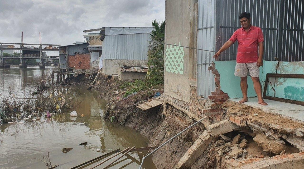
Interpreting land subsidence evidence
In managing a low-lying delta, land surface elevation needs to be monitored alongside water levels and land use. A location surveyed accurately at a given time may have changed over several years. When topographic data, infrastructure records, and water-level measurements come from different periods, drainage calculations are subject to additional uncertainty.
In response to this need, Vu Thi Thu Hien, of the Faculty of Natural Resources and Environment at the Thanh Hoa campus of Hanoi University of Natural Resources and Environment, conducted a study titled “Integrating GNSS and InSAR for land subsidence monitoring in the Vietnamese Mekong Delta to support agricultural and environmental management.” The study examines how the two data sources can be cross-validated and used to support management decisions.
The study combines a focused literature review, analysis of secondary data, and policy analysis. Published findings are standardized by unit and classified according to the measured variable, spatial coverage, and observation period. Its contribution lies in developing an analytical framework and an implementation design. The study does not process new GNSS time series or radar imagery, nor does it produce a map of land subsidence conditions for 2026.
Among the studies reviewed, Minderhoud et al. (2017) modeled the component of land subsidence attributable to groundwater extraction. Their best-estimate scenario indicated that the delta had subsided by an average of approximately 18 cm over the 25-year period beginning in 1991. The modeled average subsidence rate for 2015 was 1.1 cm per year, equivalent to 11 mm per year.
Another study by Minderhoud et al., published in 2018, analyzed InSAR observations from 2006–2010 across land-use classes that had remained stable during 1988–2006. Average subsidence rates were approximately 6 mm per year in marshland, 7 mm per year in wetland forests, 18 mm per year in mixed agricultural areas, and 20 mm per year in urban areas.
These differences reflect variation among land-use classes within the study area. According to Vu Thi Thu Hien's analysis, however, they do not establish that agricultural practices are a direct cause of land subsidence. Nor can these values be combined with the 2017 model results to construct a single trend of increasing or decreasing subsidence, because the measured variables, observation periods, and study subjects differ.
A study by Dörr et al., published in 2025, documented land subsidence of up to 7 cm over several months during the 2020 drought in some areas. Ground levels recovered during the following rainy season in certain locations, but not everywhere. In two areas, residual displacement of up to 3.5 cm remained unrecovered. These measurements represent event-related displacement and must be distinguished from annual subsidence rates.
Based on this evidence, the author recommends retaining records of displacement time series, the timing of specific events, and subsequent recovery. A map layer showing average subsidence rates may obscure significant short-term variations. Land subsidence must also be clearly distinguished from landslides, as surface deformation maps cannot replace assessments of soil-mass instability.
Integrating point-based GNSS measurements with InSAR observations
Global Navigation Satellite Systems (GNSS) provide satellite-based positioning data that can be used to track displacement at monitoring points through coordinate time series. Interferometric Synthetic Aperture Radar (InSAR) uses radar images acquired at different times to measure surface deformation over broad areas. Integrating the two data sources can connect point-based measurements with the spatial distribution of ground displacement.
However, the two methods do not automatically measure the same quantity. InSAR measures displacement along the radar line of sight (LOS), whereas GNSS can resolve displacement into eastward, northward, and vertical components. Radar measurements must therefore be interpreted in relation to the viewing geometry before being compared with GNSS-derived vertical displacement.
The author proposes two approaches to cross-validation. The first involves projecting GNSS-derived displacement onto the radar line-of-sight direction for comparison. The second uses different radar viewing geometries, together with constraints from GNSS, to estimate individual displacement components. Where information is insufficient, the resulting products must explicitly state the assumptions made and the displacement components that have been omitted.
Reference stability is another critical consideration. If a point assumed to be stationary is actually moving, the resulting InSAR deformation field may contain a systematic bias. The study recommends establishing multiple control points, using independent measurements, and maintaining reference-point records to identify systematic errors in long-term monitoring systems.
The physical object represented by each measurement point also needs to be documented. A station installed on a structure with deep foundations may register displacement that differs from that of the surrounding shallow soil. Such differences need to be interpreted in light of foundation design, geological conditions, antenna location, and equipment history.
When integrating measurements with infrastructure data, the study calls for explicit documentation of the vertical datum, transformation model, and observation date. For time series, analysis should consider long-term trends, seasonal fluctuations, abrupt changes, and residual discrepancies. Equipment replacement logs and records of changes to reference points must be checked before a detected variation is interpreted as a natural phenomenon.
The author proposes assessing mean bias and dispersion using an independent set of validation points. Points used for calibration must be distinguished from those used for evaluation. If the same data are used for both purposes, the degree of agreement between the two sources does not fully demonstrate the system's cross-validation capability.
Applying integrated data to water resources, irrigation, and agricultural production management
According to the study, system design should begin with the specific management decisions the system is intended to support. For water resources management, the data can help identify areas requiring further investigation and support monitoring following adjustments to groundwater extraction. For irrigation management, deformation information can help identify infrastructure alignments where elevation surveys should be conducted. In agricultural production areas, the data can provide additional evidence for assessing drainage conditions.
The author proposes a six-step workflow: define the geographic area, target features, and measurement variables; inventory available data sources; inspect and process each source independently; harmonize observation periods, reference systems, and viewing geometry; calibrate and integrate the data, followed by independent validation; and release the resulting products with quality information and guidance on their use.
The outputs would include displacement maps or displacement-rate maps with clearly specified measurement variables, time series at validation points, data-quality layers, and methodological documentation. Areas with insufficient data or that do not meet processing requirements must be identified separately. Missing values must not be assigned zero, and interpolated values must be identified as estimates. This distinction helps prevent areas without observations from being misinterpreted as areas with no ground displacement.
Building on this technical framework, the study proposes developing pilot guidelines for GNSS–InSAR integration and cross-validation. These guidelines should cover measured quantities, reference systems, observation times, sign conventions, reference points, and measurement uncertainty. Quality requirements should be appropriate to the intended application and established through surveys and pilot testing.
The author frames data-sharing arrangements around the responsibilities of the relevant technical agencies. Surveying agencies would ensure the consistency of reference systems and the quality of displacement measurements; water resources agencies would provide information on water levels, groundwater extraction, and hydrogeological conditions; irrigation agencies would define requirements for elevation data and infrastructure; and local authorities would verify relevant features and organize field measurements.
Coordination requires a data inventory, designated contacts for verification, update schedules, access rights, and procedures for resolving discrepancies. Each product should include source documentation and version history to ensure traceability. If a location changes priority between reporting periods, users should be able to determine whether the change reflects actual ground movement or differences in data processing.
For groundwater management, significant deformation signals should trigger checks on data reliability, field investigations, and comparisons with relevant technical records. Conclusions about the causes of deformation or the need for intervention require additional evidence. Similarly, adjustments to infrastructure, crops, or cropping seasons should be based on a combination of hydrological data, soil information, water resources data, and expert assessment.
The study recommends conducting pilot projects with clearly defined management questions, sufficient data sources, and independent validation points. Evaluation should cover data quality, continuity, traceability, practical applications, and maintenance costs. Budget planning should account for surveys, data processing, validation measurements, maintenance, storage, updates, and user support.
The value of this integrated approach will be demonstrated when the data meet quality requirements and help address specific management needs. In the Vietnamese Mekong Delta, the approach could provide a basis for identifying locations requiring repeat measurements, further investigation, and continued monitoring of changes, progressively linking ground deformation monitoring with natural resource management and agricultural production.