




 A study conducted in Xuan Thuy National Park combined field survey data with Sentinel-1 and Sentinel-2 remote sensing data and machine learning algorithms to identify and model the spatial distribution of mangrove species composition across the forest area. The results showed that Kandelia obovata (Trang) and assemblages containing K. obovata accounted for most of the mangrove forest area, while demonstrating the potential of multi-sensor remote sensing data for monitoring species distribution.
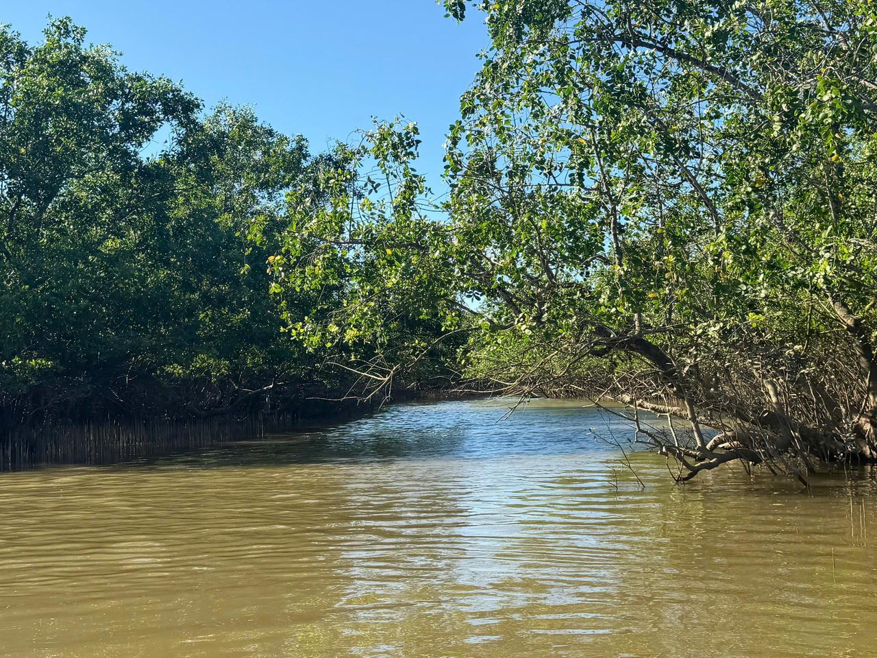
Species-level mapping matters for mangrove forest management
Mangrove forests are often assessed primarily in terms of their extent and changes in forest cover. However, in an ecosystem where multiple species coexist, identifying forest boundaries alone is insufficient to fully characterize the ecological attributes of plant communities. Identifying species composition also helps clarify distribution patterns, the dominance of individual species, and the mixed-species assemblages occurring within mangrove forests.
This provides a basis for monitoring changes in vegetation structure, supporting ecological research, and contributing to biodiversity conservation. According to the authors of the study, “Spatial distribution of mangrove species in Xuan Thuy National Park (Ninh Binh, Viet Nam) based on machine learning and multi-sensor remote sensing data,” although remote sensing has been widely used for mangrove forest mapping, species-level studies remain limited, particularly those covering the entire Xuan Thuy National Park using open-access data sources.
Xuan Thuy provides suitable conditions for addressing this research challenge. Located in the Ba Lat Estuary, the park is strongly influenced by hydrological processes and sediment deposition, giving rise to a diverse wetland ecosystem. Mangrove forests within the park are dominated by K. obovata (Trang) and Aegiceras corniculatum (Sú).
Rather than focusing solely on the presence or absence of mangrove forests, the study by Le Nhu Nga, Ngo Xuan Chieu, Nguyen Xuan Tung, Pham Thi Minh Hanh, and Dinh Thi Diu aimed to identify mangrove species and species assemblages and to model their spatial distribution and area across the study area. This approach provides more detailed information on the compositional structure of mangrove forests than estimates of overall forest extent alone.
Field surveys provide the basis for species mapping
Field surveys remained the starting point of the study. The authors used 121 field survey plots across the mangrove forest area of Xuan Thuy National Park. At each site, a 10 × 10 m sample plot was established to record the number of individuals, measure tree dimensions, and determine species composition. The dataset combined surveys conducted in 2018 and 2023 with additional samples provided by Xuan Thuy National Park staff.
The field surveys identified four monospecific stand types and eight dominant mixed-species assemblages, including K. obovata (Trang), A. corniculatum (Sú), Rhizophora stylosa (Đước vòi), Avicennia marina (Mấm biển), and assemblages such as K. obovata–A. corniculatum and K. obovata–R. stylosa. These field observations served as reference data for developing and validating the classification models based on satellite imagery.
The remote sensing dataset was constructed from two complementary sources: Sentinel-2 optical imagery and Sentinel-1 radar data. Following preprocessing, spectral bands, vegetation indices, water indices, and radar-derived features were combined into the model input dataset. This approach allowed the models to exploit multiple characteristics of the vegetation rather than relying on a single type of remote sensing data.
Using these data, the authors compared five algorithms: Support Vector Machine (SVM), Extreme Gradient Boosting (XGBoost), CatBoost, Multi-layer Perceptron (MLP), and Maximum Likelihood Classifier (MLC). The data were divided into training and validation sets, with cross-validation and hyperparameter optimization incorporated to reduce the extent to which model performance depended on a single data split.
A notable feature of the approach is that remote sensing was not used as a substitute for field surveys. Instead, satellite-derived information was integrated with field observations and validation data to extend information from individual survey plots into a spatial representation covering the study area. This provided the basis for evaluating model performance and assessing what the resulting species-composition maps could reveal about the mangrove forests of Xuan Thuy.
Kandelia obovata dominates mangrove composition
The modeling results showed that mangrove forests in Xuan Thuy are clearly dominated by several species and species assemblages. The total mangrove area identified by the CatBoost model was 1,402.76 hectares. Of this area, K. obovata accounted for 496.19 hectares, or 35.37%; the K. obovata–A. corniculatum assemblage covered 411.41 hectares, while K. obovata–R. stylosa covered 256.38 hectares. Together, these three compositional types accounted for approximately 83% of the classified mangrove forest area.
The results indicate that K. obovata not only accounted for a large share of monospecific stands but also occurred in several assemblages covering substantial areas. Other distribution types occupied smaller areas, including K. obovata–Sonneratia assemblages, A. marina, A. marina–K. obovata, A. marina–A. corniculatum, A. corniculatum–K. obovata, and R. stylosa. This pattern reflects a forest system in which dominant species form relatively extensive communities alongside areas characterized by mixtures of multiple species.
Notably, some species recorded during field surveys were not included in the final classification because they occurred at low frequencies or were interspersed beneath the canopies of dominant species. In such cases, the signals captured by satellite imagery can be strongly influenced by dominant species, making it difficult to identify components that account for only a small proportion of a pixel.
This also indicates that maps derived from remote sensing data need to be interpreted in relation to field characteristics of the plant communities. The value of the results lies not only in estimating the area of individual classes, but also in identifying dominant distribution patterns across the study area and providing additional spatial information for mangrove forest monitoring.
High overall accuracy, but complex assemblages remain difficult to distinguish
Among the five models tested, CatBoost produced the best results, with an overall accuracy (OA) of 0.95. XGBoost and MLP both achieved 0.94, while SVM and MLC achieved 0.82 and 0.50, respectively. The F1-score and Kappa statistics also indicated relatively stable performance among the boosting-based models within the study dataset.
Based on the validation results, CatBoost and MLP were selected to produce the final classification maps. The two models generated relatively similar spatial distributions; however, the CatBoost results showed a more concentrated and consistent pattern and were therefore used to calculate the areas of the different mangrove compositional types.
However, a high overall accuracy does not mean that all components of the forest were identified with the same level of accuracy. This limitation was clearly demonstrated in the study. Mixed-species assemblages with multiple components are difficult to distinguish when subordinate species occur sporadically or regenerate beneath the canopy, because the signal of each pixel is primarily influenced by dominant species. The case of the Sonneratia class also illustrates this limitation, as the number of training samples for the monospecific class was insufficient for the model to distinguish it effectively.
The authors consider this limitation to be partly attributable to the use of medium-resolution Sentinel-2 optical imagery combined with Sentinel-1 C-band synthetic aperture radar (SAR) data and a pixel-based classification approach. The proposed directions for improvement include incorporating higher-resolution data, exploiting texture features and object-based segmentation, and considering L-/P-band SAR data, which may provide additional information on forest structure.
From an application perspective, the study indicates that combining Sentinel-1 and Sentinel-2 data with machine learning can support the generation of mangrove species-composition maps over relatively large areas using open-access data and a relatively limited number of field samples. This represents an approach that can complement field surveys in monitoring the spatial distribution of mangrove forests. Nevertheless, improving map reliability, particularly for communities with complex species composition, will require additional field data and remote sensing sources with appropriate spatial resolution.
Source: This article is based on the research paper “Spatial distribution of mangrove species in Xuan Thuy National Park (Ninh Binh, Viet Nam) based on machine learning and multi-sensor remote sensing data” by Le Nhu Nga, Ngo Xuan Chieu, Nguyen Xuan Tung, Pham Thi Minh Hanh, and Dinh Thi Diu, published in the Science Journal of Agriculture and Environment, Issue 2, May 2026.
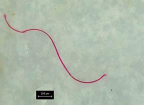
Abstract. Microplastics (MPs) in the environment have significantly impacted ecosystems and threatened human health. This study investigated the distribution and characteristics of MPs in the Nhue- Day River basin in Vietnam, which used to be a source of critical biodiversity and support for the economic growth of about 12 million people. The effect of seasonal variation and anthropogenic activities on the MP abundance was assessed. The findings revealed that the amount of pollution produced by MP abundance was significant in this study area. The average abundance of MPs in the dry season (754 items/m3) was higher than that in the rainy season (706 items/m3) with n=9. The range in the abundance of MPs in the dry and rainy seasons was 49-2,827 and 400-1,133 items/m3, respectively. The MPs collected in this study were mainly small-sized particles, with a significant proportion distributed in the 0.5- 2.0 mm size range. However, the present study showed that the relationship between MPs a

On April 1st, Ho Chi Minh City International University (HCMIU) in collaboration with Deakin University in Australia organized the fourth edition of the Young Environmentalist Challenge.

On March 9th in Hanoi, the Environmental Pollution Control Department reported on the progress of developing national environmental technical standards. Deputy Minister of the Ministry of Natural Resources and Environment, Mr. Vo Tuan Nhan, chaired the meeting and provided guidance.

Resolution No. 50/2022 dated June 13, 2022, of the National Assembly mentions the addition of the Water Resources Law to the 2023 legislative program, adjusting the program for 2022. Accordingly, the amended Water Resources Law will be presented for the National Assembly's opinions during the 5th session and is scheduled for approval during the 6th session in 2023.
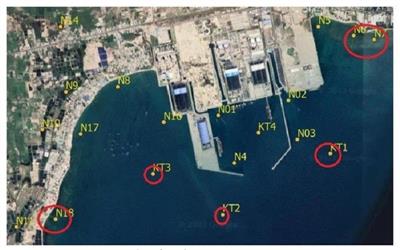
Researchers of the National Remote Sensing Department have successfully researched and applied remote sensing technology in monitoring a number of environmental parameters in a thermal power plant, and at the same time developed and proposed suitable technologies to monitor PM10, PM2.5 pollution in the air, temperature and suspended solid content in water and fluctuations in ash disposal site and its cover at the area of the thermal power plant.